
Elizabeth’s guidebook
Neighborhoods
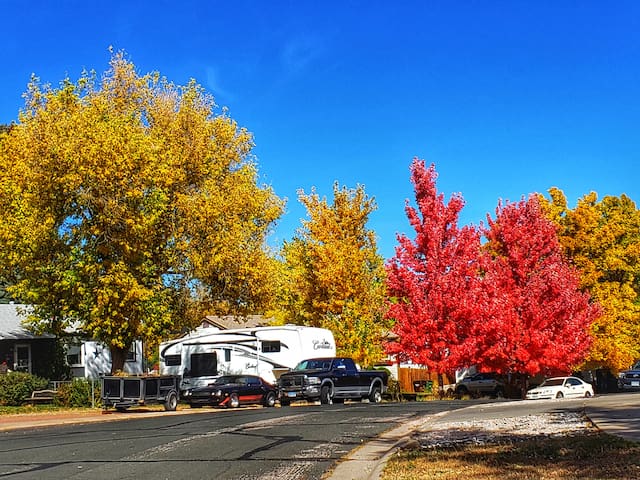
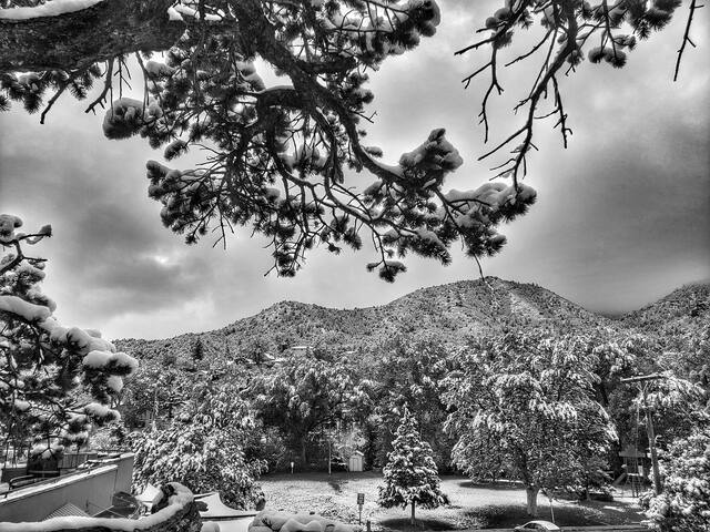
Knob Hill, is a neighborhood of Colorado Springs in El Paso County, Colorado, is located northeast of downtown Colorado Springs.
Colorado School for the Deaf and Blind
School for the Deaf and the Blind, St. Francis Hospital, and the National Deaconess Sanitarium, 1909
The Colorado Institute of the Education of the Mutes (now Colorado School for the Deaf and Blind) was founded by Jonathan R. Kennedy and opened on April 8, 1874. The school began with a Territorial appropriation of $5,000. It first operated in a rented house with seven students. Kennedy, who had worked at the Kansas State School for the Deaf, was the director of the school. He and his wife had children who attended the school.[3][4] William Jackson Palmer donated land to build a permanent school on Knob Hill, 1 mile (1.6 km) east of Colorado Springs.[3][4] In 2014, there are 500 students across the state.[4]
Union Printers Home
The Childs-Drexel Home for Union Printers was dedicated on May 12, 1892. It was run by the International Typographical Union to take care of ill and elderly patients. The home was bought by Heart Living Centers in 2014.
Tesla Experimental Station Edit
The inventor Nikola Tesla's wireless power experimental station was located on Knob Hill at a site near the current Kiowa and Foote Streets, between the Colorado School for the Deaf and Blind and the Union Printers' Home. It was built and operated in 1899 and was torn down in 1904. A street car came to Knob Hill, at that time at the edge of the prairie.
St. Francis Hospital
The St. Francis Hospital was built on Institute Heights at the east end of Pike's Peak Avenue, near the Knob Hill street car line.
The Pikes Peak Gun Club was on Knob Hill near the city limits.
The Knob Hill Auction Company held monthly auctions on the hill to sell horses. Livestock was sold weekly on Knob Hill, where there was also a nearby cafe.
Knob Hill
Knob Hill, is a neighborhood of Colorado Springs in El Paso County, Colorado, is located northeast of downtown Colorado Springs.
Colorado School for the Deaf and Blind
School for the Deaf and the Blind, St. Francis Hospital, and the National Deaconess Sanitarium, 1909
The Colorado Institute of the Education of the Mutes (now Colorado School for the Deaf and Blind) was founded by Jonathan R. Kennedy and opened on April 8, 1874. The school began with a Territorial appropriation of $5,000. It first operated in a rented house with seven students. Kennedy, who had worked at the Kansas State School for the Deaf, was the director of the school. He and his wife had children who attended the school.[3][4] William Jackson Palmer donated land to build a permanent school on Knob Hill, 1 mile (1.6 km) east of Colorado Springs.[3][4] In 2014, there are 500 students across the state.[4]
Union Printers Home
The Childs-Drexel Home for Union Printers was dedicated on May 12, 1892. It was run by the International Typographical Union to take care of ill and elderly patients. The home was bought by Heart Living Centers in 2014.
Tesla Experimental Station Edit
The inventor Nikola Tesla's wireless power experimental station was located on Knob Hill at a site near the current Kiowa and Foote Streets, between the Colorado School for the Deaf and Blind and the Union Printers' Home. It was built and operated in 1899 and was torn down in 1904. A street car came to Knob Hill, at that time at the edge of the prairie.
St. Francis Hospital
The St. Francis Hospital was built on Institute Heights at the east end of Pike's Peak Avenue, near the Knob Hill street car line.
The Pikes Peak Gun Club was on Knob Hill near the city limits.
The Knob Hill Auction Company held monthly auctions on the hill to sell horses. Livestock was sold weekly on Knob Hill, where there was also a nearby cafe.
Charming shopping and dining area at the foot of the mountains. Nightlife and bars abound! The Colorado Creamery and Rocky Mountain Chocolate Factory are not to be missed! For dining I recommend Tapas, or Jake and Telly's for excellent Greek food and a great balcony
388 persone del luogo consigliano
Vecchia Città del Colorado
Charming shopping and dining area at the foot of the mountains. Nightlife and bars abound! The Colorado Creamery and Rocky Mountain Chocolate Factory are not to be missed! For dining I recommend Tapas, or Jake and Telly's for excellent Greek food and a great balcony
Sightseeing
Hiking, mountain biking, dog park and picnic areas. A great place to get a workout in, or de-stress on a nature walk.
176 persone del luogo consigliano
Palmer Park
3344-3376 Paseo RdHiking, mountain biking, dog park and picnic areas. A great place to get a workout in, or de-stress on a nature walk.
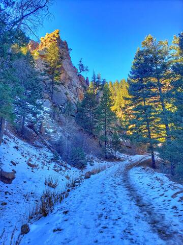
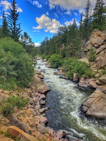
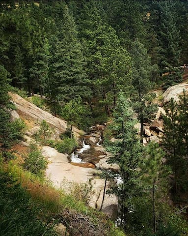
North Cheyenne Cañon Park is located on the southwest side of Colorado Springs. North Cheyenne Cañon Park is cut 1,000-feet deep into the 1.5 billion-year-old granite rock. This 1,600-acre park provides good habitat for large animals such as the Black Bear, Mountain Lion and Mule Deer, and little birds that love water, like the Kingfisher, American Dipper and Broad-tailed Hummingbird.
North Cheyenne Creek runs along the bottom of the canyon. Visitors can drive, hike and bike from the entrance of the canyon up to Helen Hunt Falls. Beyond Helen Hunt Falls, North Cheyenne Canyon Road continues until it reaches Gold Camp Road. There is a large parking area where bikers, hikers and runners can access additional trails.
114 persone del luogo consigliano
North Cheyenne Cañon Park
15220 S Cheyenne Canyon RdNorth Cheyenne Cañon Park is located on the southwest side of Colorado Springs. North Cheyenne Cañon Park is cut 1,000-feet deep into the 1.5 billion-year-old granite rock. This 1,600-acre park provides good habitat for large animals such as the Black Bear, Mountain Lion and Mule Deer, and little birds that love water, like the Kingfisher, American Dipper and Broad-tailed Hummingbird.
North Cheyenne Creek runs along the bottom of the canyon. Visitors can drive, hike and bike from the entrance of the canyon up to Helen Hunt Falls. Beyond Helen Hunt Falls, North Cheyenne Canyon Road continues until it reaches Gold Camp Road. There is a large parking area where bikers, hikers and runners can access additional trails.
Make the iconic drive up America's Mountain, Pikes Peak. As well as being an easy access 14er, there's the cog railway, several reservoirs and several gift shops and interpretative sites.
681 persone del luogo consigliano
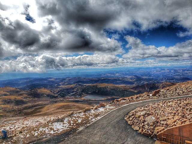
Pikes Peak Summit House
Make the iconic drive up America's Mountain, Pikes Peak. As well as being an easy access 14er, there's the cog railway, several reservoirs and several gift shops and interpretative sites.
https://www.sunwellness.net/
Soak in mineral water in barrel hot tubs, get a massage or facial, attend yoga or any combination of the above! Reservations recommended, pricing is very reasonable. Choose to all that Manitou Springs has to offer!
71 persone del luogo consigliano
SunWater Spa
514 El Paso Blvdhttps://www.sunwellness.net/
Soak in mineral water in barrel hot tubs, get a massage or facial, attend yoga or any combination of the above! Reservations recommended, pricing is very reasonable. Choose to all that Manitou Springs has to offer!
Great for exploring, rock climbing, horse riding, drives and scenery galore!
238 persone del luogo consigliano
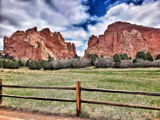
Garden of the Gods
1805 N 30th StGreat for exploring, rock climbing, horse riding, drives and scenery galore!
Eleven Mile State Park is one of Colorado's largest reservoirs with 325 campsites and trophy fishing for trout, kokanee and pike. Nearby Spinney Reservoir is a day-use park open spring-fall boasting a Gold Medal Trout Fishery and a productive Pike Fishery.
28 persone del luogo consigliano
Eleven Mile Canyon Recreation Area
County Road 96Eleven Mile State Park is one of Colorado's largest reservoirs with 325 campsites and trophy fishing for trout, kokanee and pike. Nearby Spinney Reservoir is a day-use park open spring-fall boasting a Gold Medal Trout Fishery and a productive Pike Fishery.
The Crags are rock formations located south of Divide, facing the northwest slope of Pikes Peak. It's a beautiful hike popular with families.
Start at the new trailhead heading east through a couple of steep switchbacks. Soon you will reach the sign for trail #664A pointing the the right. This trail goes up to Pikes Peak via Devil's Playground, keep left following trail #664. Shortly after, the trail enters a meadow with numerous interesting rock formations on the left. The trail is pretty level and it's an easy walk through this incredible area. The final push is in the forest again, climbing until you reach the top of Crags. Enjoy great views of Pikes Peak and mountains to the north and west. Be sure to check out the ancient Bristle Cone Pines on the summit.
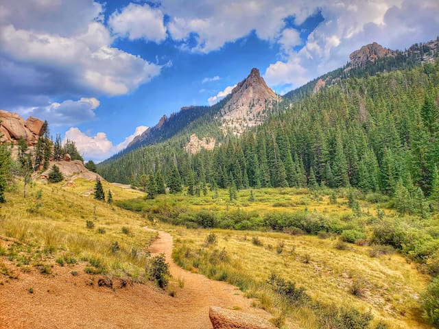
The Crags Campground
The Crags are rock formations located south of Divide, facing the northwest slope of Pikes Peak. It's a beautiful hike popular with families.
Start at the new trailhead heading east through a couple of steep switchbacks. Soon you will reach the sign for trail #664A pointing the the right. This trail goes up to Pikes Peak via Devil's Playground, keep left following trail #664. Shortly after, the trail enters a meadow with numerous interesting rock formations on the left. The trail is pretty level and it's an easy walk through this incredible area. The final push is in the forest again, climbing until you reach the top of Crags. Enjoy great views of Pikes Peak and mountains to the north and west. Be sure to check out the ancient Bristle Cone Pines on the summit.
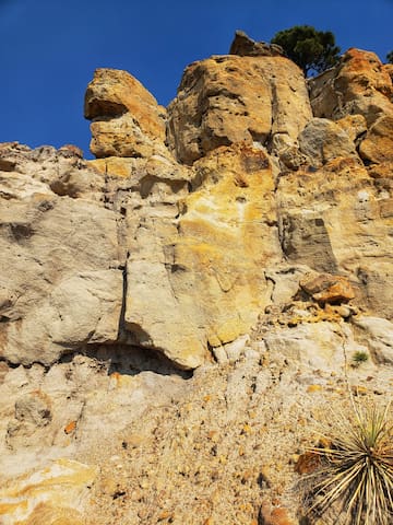
Rated as one of Colorado’s most colorful places, the Paint Mines park boasts 750 acres of land that contains evidence of human life dating as far back as 9,000 years ago. Unusual geological formations of winding gulches, hoodoos, spires and surrounding grassy meadows with visible wildflowers through late summer, are just some of the details that make this park so special.
72 persone del luogo consigliano
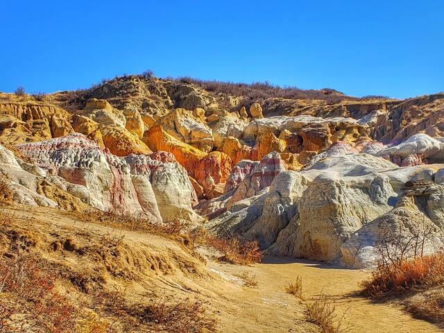
Parco Interpretativo di Paint Mines
29950 Paint Mine RdRated as one of Colorado’s most colorful places, the Paint Mines park boasts 750 acres of land that contains evidence of human life dating as far back as 9,000 years ago. Unusual geological formations of winding gulches, hoodoos, spires and surrounding grassy meadows with visible wildflowers through late summer, are just some of the details that make this park so special.
Lake Pueblo, rated a fishing “hot spot,” provides over 4,600 surface acres of water, 60 miles of shoreline and almost 10,000 acres of land. Along with the sunny days and a mild year-round climate, visitors quickly learn that one day is not enough.
Full service marinas and a diversity of campsites welcome guests to stay awhile. Water recreation includes sailing, motor-boating, waterskiing, river tubing and prime fishing. Boaters choose from two full-service marinas and boat ramps.
Land recreation includes hiking, biking, picnicking and diverse nature exploration. Miles of trails make it easy to discover the beauty of the shady Arkansas River below the dam or the wonder of 200-year-old Juniper trees. Wet or dry activities culminate with camping options that encourage a day of play to become a mini-vacation.
Views of the Greenhorn and Wet mountain ranges to the southwest and the magnificent Pikes Peak to the north are a splendid way to end the day. It is no wonder that Lake Pueblo State Park is a favorite destination
36 persone del luogo consigliano
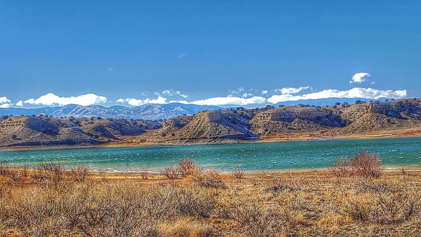
Pueblo Reservoir
Lake Pueblo, rated a fishing “hot spot,” provides over 4,600 surface acres of water, 60 miles of shoreline and almost 10,000 acres of land. Along with the sunny days and a mild year-round climate, visitors quickly learn that one day is not enough.
Full service marinas and a diversity of campsites welcome guests to stay awhile. Water recreation includes sailing, motor-boating, waterskiing, river tubing and prime fishing. Boaters choose from two full-service marinas and boat ramps.
Land recreation includes hiking, biking, picnicking and diverse nature exploration. Miles of trails make it easy to discover the beauty of the shady Arkansas River below the dam or the wonder of 200-year-old Juniper trees. Wet or dry activities culminate with camping options that encourage a day of play to become a mini-vacation.
Views of the Greenhorn and Wet mountain ranges to the southwest and the magnificent Pikes Peak to the north are a splendid way to end the day. It is no wonder that Lake Pueblo State Park is a favorite destination
Red Rock Canyon is characterized by a series of canyons and ridges sculpted by erosion of the area’s uplifted rock strata. The ridges and canyons offer beautiful views and sheltered enclaves for inspiration, varied terrain for recreation, and a 240 million year slice of sedimentary geology for education. The varied terrain and geology support a wide variety of plant and animal communities. Human use of the area has left a heritage of varied and colorful history including Ute defensive positions, stone quarries, and gold mills.
Amenities
Off-leash dog area
Picnic Pavilion
Rock climbing (permit required)
Portable toilets at both main parking lots
Dirt trails for pedestrians, bikes, horses and leashed dogs (on trails other than the off-leash areas)
Connection to Section 16 and Intemann Trail
Bike only area
Trails
Download printable trail map
Contemplative Trail
Sand Canyon Trail
Mesa/Greenlee Trail loop
Roundup Trail
Upper and Lower dog loops (off-leash dog areas)
Quarry Trail
Hogback Trail/Lion Loop
430 persone del luogo consigliano
Area Aperta di Red Rock Canyon
3550 W High StRed Rock Canyon is characterized by a series of canyons and ridges sculpted by erosion of the area’s uplifted rock strata. The ridges and canyons offer beautiful views and sheltered enclaves for inspiration, varied terrain for recreation, and a 240 million year slice of sedimentary geology for education. The varied terrain and geology support a wide variety of plant and animal communities. Human use of the area has left a heritage of varied and colorful history including Ute defensive positions, stone quarries, and gold mills.
Amenities
Off-leash dog area
Picnic Pavilion
Rock climbing (permit required)
Portable toilets at both main parking lots
Dirt trails for pedestrians, bikes, horses and leashed dogs (on trails other than the off-leash areas)
Connection to Section 16 and Intemann Trail
Bike only area
Trails
Download printable trail map
Contemplative Trail
Sand Canyon Trail
Mesa/Greenlee Trail loop
Roundup Trail
Upper and Lower dog loops (off-leash dog areas)
Quarry Trail
Hogback Trail/Lion Loop
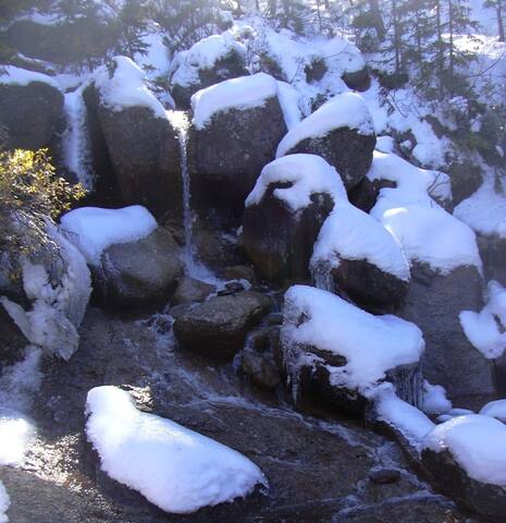
Helen Hunt Falls is a waterfall located on Cheyenne Creek in the North Cheyenne Cañon Park of Colorado Springs, Colorado. The falls are located on North Cheyenne Creek immediately off North Cheyenne Canyon Road in the North Cheyenne Canyon Park
169 persone del luogo consigliano
Cascate di Helen Hunt
3440 North Cheyenne Canyon Road
Helen Hunt Falls is a waterfall located on Cheyenne Creek in the North Cheyenne Cañon Park of Colorado Springs, Colorado. The falls are located on North Cheyenne Creek immediately off North Cheyenne Canyon Road in the North Cheyenne Canyon Park
Camping is permitted along the trail and is recommended 300’ from any trail or stream. Use no-impact camping techniques. Pack it in/Pack it out rule applies. Campfire permits are not required but please be sure your fire is dead out before you leave. Respect other trail users.
Drinking water is not readily available. Hikers are advised to carry an adequate supply.
Motorized vehicles are prohibited. Foot and horse trail.
Description
From Colorado Springs, take Hwy 24, through Woodland Park, to Divide. Turn south on Hwy 67. Drive 8 miles until you come to a tunnel. Parking is available on the other side of the tunnel. This is where the trail begins.
Take Horsethief Park Trail (#704) about .7 miles from the parking area to the first fork. This section of the trail is an abundantly used, spacious path with a slight incline that runs parallel to an Oil Creek tributary.
At the first fork, go to the left and cross over the stream.
Flora & Fauna
Willows, Aspen, Mixed Pine, Beavers, Black Crows
Contacts
19 persone del luogo consigliano
Horsethief Park Trailhead
Colorado 67Camping is permitted along the trail and is recommended 300’ from any trail or stream. Use no-impact camping techniques. Pack it in/Pack it out rule applies. Campfire permits are not required but please be sure your fire is dead out before you leave. Respect other trail users.
Drinking water is not readily available. Hikers are advised to carry an adequate supply.
Motorized vehicles are prohibited. Foot and horse trail.
Description
From Colorado Springs, take Hwy 24, through Woodland Park, to Divide. Turn south on Hwy 67. Drive 8 miles until you come to a tunnel. Parking is available on the other side of the tunnel. This is where the trail begins.
Take Horsethief Park Trail (#704) about .7 miles from the parking area to the first fork. This section of the trail is an abundantly used, spacious path with a slight incline that runs parallel to an Oil Creek tributary.
At the first fork, go to the left and cross over the stream.
Flora & Fauna
Willows, Aspen, Mixed Pine, Beavers, Black Crows
Contacts
St.Mary's Falls (Trail #624) is an intermediate hike in the Cheyenne Canyon Area. The trailhead is located just above Helen Hunt Falls at the intersection of High Drive and Gold Camp Road.
For the first mile the trail follows Gold Camp Road making a 180 degree turn. A detour takes you around the collapsed tunnel. The trail then continues along a creek through the Buffalo Canyon.
After about 1.7 miles you will reach the sign pointing to the base of the St Marys' Falls. Enjoy the falls and if you feel like it continue up through several switchbacks to the top of the falls along the trail leading to Mount Rosa.
St Mary's Falls
St.Mary's Falls (Trail #624) is an intermediate hike in the Cheyenne Canyon Area. The trailhead is located just above Helen Hunt Falls at the intersection of High Drive and Gold Camp Road.
For the first mile the trail follows Gold Camp Road making a 180 degree turn. A detour takes you around the collapsed tunnel. The trail then continues along a creek through the Buffalo Canyon.
After about 1.7 miles you will reach the sign pointing to the base of the St Marys' Falls. Enjoy the falls and if you feel like it continue up through several switchbacks to the top of the falls along the trail leading to Mount Rosa.
Activities
My yoga studio! Great drop in class rates, many levels and times of classes and world class instructors! An unpretentious and body positive environment of acceptance.
6 persone del luogo consigliano
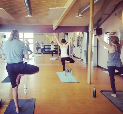
CorePower Yoga
623 N Nevada AveMy yoga studio! Great drop in class rates, many levels and times of classes and world class instructors! An unpretentious and body positive environment of acceptance.
CityROCK opened its doors in December 2009. The Rock officially closed in 2011. Since its opening, CityROCK has been a focal point for local climbers who see our gym as a great place to train for outside adventures and for those looking to be part of a wonderful community, the same community that has supported us through the years, especially during our latest remodel and beautification project.
CityROCK is now a climbing gym with a full training and fitness area, a yoga studio, a kids area, and a restaurant. The Ute & Yeti restaurant was named to honor the restaurant “The Yak and Yeti” in Kathmandu, Nepal, a restaurant known as a stopping point for mountaineers coming off Everest. The Ute & Yeti was founded with the help of UpaDowna, a local non-profit whose mission is to provide access to outdoor adventures for all, through events and programs that empower individuals, create healthier communities, and foster a respect for the environment.
2019 was CityROCK’s 10th anniversary. 10 years of happiness, of dreams coming true, of hard work and great achievements, of togetherness and long-lasting friendships. It’s been 10 beautiful years, and we would like to celebrate with our members, guests, and others who consider CityROCK a big or small part of their lives.
38 persone del luogo consigliano
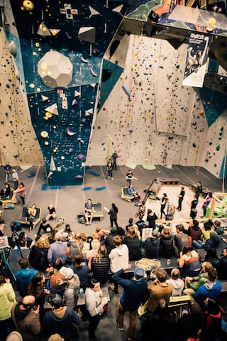
CityROCK
21 N Nevada AveCityROCK opened its doors in December 2009. The Rock officially closed in 2011. Since its opening, CityROCK has been a focal point for local climbers who see our gym as a great place to train for outside adventures and for those looking to be part of a wonderful community, the same community that has supported us through the years, especially during our latest remodel and beautification project.
CityROCK is now a climbing gym with a full training and fitness area, a yoga studio, a kids area, and a restaurant. The Ute & Yeti restaurant was named to honor the restaurant “The Yak and Yeti” in Kathmandu, Nepal, a restaurant known as a stopping point for mountaineers coming off Everest. The Ute & Yeti was founded with the help of UpaDowna, a local non-profit whose mission is to provide access to outdoor adventures for all, through events and programs that empower individuals, create healthier communities, and foster a respect for the environment.
2019 was CityROCK’s 10th anniversary. 10 years of happiness, of dreams coming true, of hard work and great achievements, of togetherness and long-lasting friendships. It’s been 10 beautiful years, and we would like to celebrate with our members, guests, and others who consider CityROCK a big or small part of their lives.