
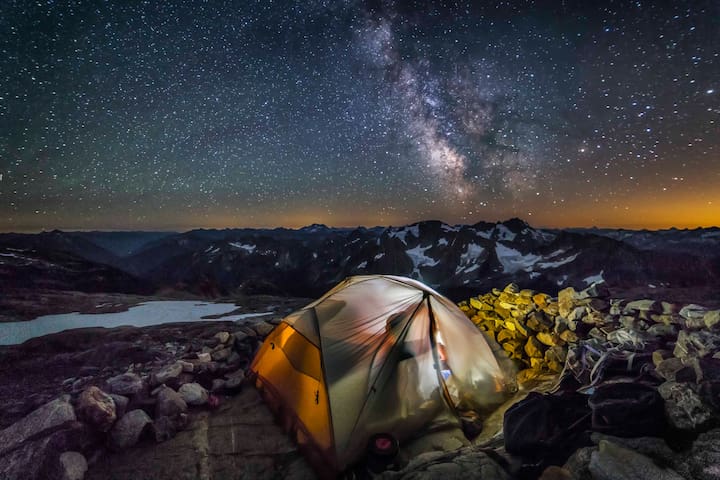
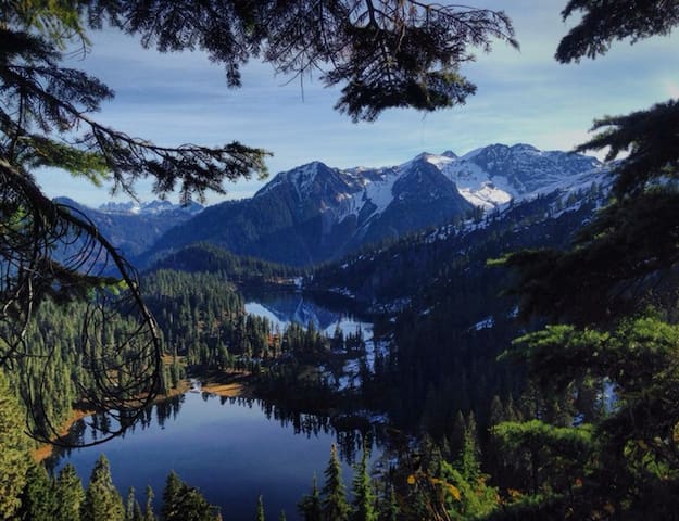
Exploring River’s Run
Sightseeing
These silos are from the old concrete manufacturer that closed in the 1960s. The "Welcome to Concrete" words were painted on in 1992 for the filming of This Boy's Life with Robert De Niro and Leonardo DiCaprio.
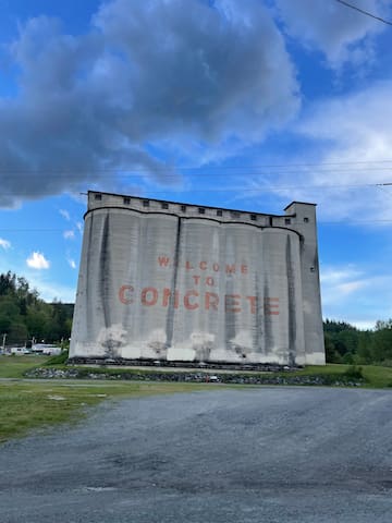
Superior Portland Cement Silos
7503 South Superior AvenueThese silos are from the old concrete manufacturer that closed in the 1960s. The "Welcome to Concrete" words were painted on in 1992 for the filming of This Boy's Life with Robert De Niro and Leonardo DiCaprio.
In the winter months, there is a massive bald eagle migration. The center offers free guided tours along the river.
8 persone del luogo consigliano
Bald Eagle Interpretive Center
52804 Rockport Park RdIn the winter months, there is a massive bald eagle migration. The center offers free guided tours along the river.
Built in 1916-1918, it was named for the Skagit County Commissioner who promoted its construction. At the time, its graceful arch was the longest single-span cement bridge in the world, and is listed on the National Historic Register.
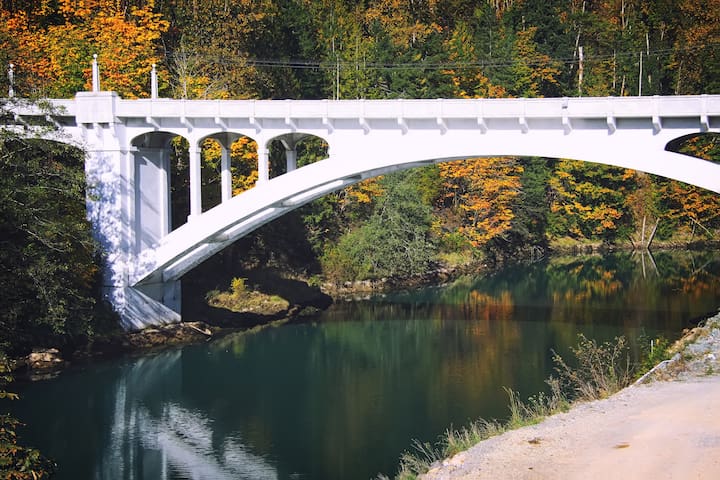
Henry Thompson Bridge
Built in 1916-1918, it was named for the Skagit County Commissioner who promoted its construction. At the time, its graceful arch was the longest single-span cement bridge in the world, and is listed on the National Historic Register.
Completed in 1925 and raised to 293 feet in 1927, it was the highest hydroelectric dam in the world at that time.
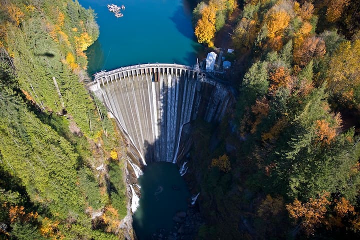
Lower Baker Dam
6754 Baker River RoadCompleted in 1925 and raised to 293 feet in 1927, it was the highest hydroelectric dam in the world at that time.
Owned and managed by Seattle City Light,
Newhalem is part of the Skagit Hydroelectric
Project, which extends 40 miles along the Skagit
River from Newhalem to the Canadian border. City
Light has generated hydroelectric power on the
upper Skagit River since 1918. There are now three
dams on the river and one on a nearby creek that
provide power to the citizen-owners in Seattle.
These engineering marvels are a testament to the
vision and foresight of James Delmage (J.D.) Ross,
one of the first superintendents of City Light. The
steep canyons of the upper Skagit River provided
ideal locations for generating power. The waterfalls
in the canyon immediately upstream of Newhalem
also formed a natural barrier that kept fish from
spawning farther up-river.
7 persone del luogo consigliano
Newhalem
Owned and managed by Seattle City Light,
Newhalem is part of the Skagit Hydroelectric
Project, which extends 40 miles along the Skagit
River from Newhalem to the Canadian border. City
Light has generated hydroelectric power on the
upper Skagit River since 1918. There are now three
dams on the river and one on a nearby creek that
provide power to the citizen-owners in Seattle.
These engineering marvels are a testament to the
vision and foresight of James Delmage (J.D.) Ross,
one of the first superintendents of City Light. The
steep canyons of the upper Skagit River provided
ideal locations for generating power. The waterfalls
in the canyon immediately upstream of Newhalem
also formed a natural barrier that kept fish from
spawning farther up-river.
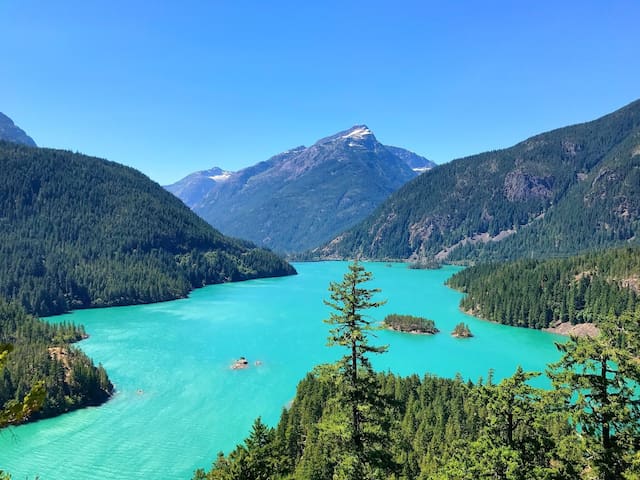
Breathtaking views of the electric blue Diablo Lake.
9 persone del luogo consigliano
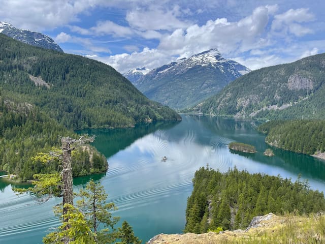
Punto panoramico del lago Diablo
State Route 20Breathtaking views of the electric blue Diablo Lake.
The Overlook to Ross Lake is much smaller than that of Diablo Lake, but the view still beautiful. It is basically a turnout with no facilities. It can be found 3.5 miles east of Diablo Lake Overlook, and is immediately after the Ross Dam Trail if heading eastbound.
Ross Lake Overlook
The Overlook to Ross Lake is much smaller than that of Diablo Lake, but the view still beautiful. It is basically a turnout with no facilities. It can be found 3.5 miles east of Diablo Lake Overlook, and is immediately after the Ross Dam Trail if heading eastbound.
This very short trail provides astonishing views of nature’s beauty as well as humanity's technological “improvements” upon it. Half this loop is paved, allowing an out-and-back for all family members, while the remaining graveled loop section is never steep nor too challenging.
Terrain in the North Cascades is famously steep and rocky with cascading torrents of water. True to that form, this trail winds around a small knob of granite left behind after the last ice age. Deep down below its southern flanks, the Skagit River once coursed through this gorge.
Since its completion in 1961, the Gorge Dam has been providing electricity to Seattle’s residents. This dam is just one of many that harnesses the waters of the Skagit. Collectively the lakes formed make up the Ross Lake National Recreation Area.
Views from the trail include a hundred foot plus cataract, which drops through a narrow defile in the rock. More close at hand are heavy moss and fern carpets. Note, as you circumnavigate this knob, how the flora changes depending on the exposure. Informative signboards complete this quick leg-stretcher along Highway 20.
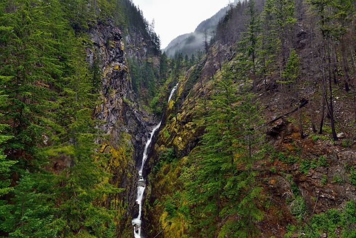
For those who love waterfalls don’t be so quick to jump back in your car. Crossing the highway, where and when it is safe, there is a short sidewalk to access a bridge. This bridge spans a side chasm, one of the many tributaries of the Skagit below. In the back of this chasm is a multi-tiered waterfall. The metal grated, bridge decking is wonderfully vertigo inducing as well.
https://www.wta.org/go-hiking/hikes/gorge-lake-overlook
Gorge Overlook Trail
This very short trail provides astonishing views of nature’s beauty as well as humanity's technological “improvements” upon it. Half this loop is paved, allowing an out-and-back for all family members, while the remaining graveled loop section is never steep nor too challenging.
Terrain in the North Cascades is famously steep and rocky with cascading torrents of water. True to that form, this trail winds around a small knob of granite left behind after the last ice age. Deep down below its southern flanks, the Skagit River once coursed through this gorge.
Since its completion in 1961, the Gorge Dam has been providing electricity to Seattle’s residents. This dam is just one of many that harnesses the waters of the Skagit. Collectively the lakes formed make up the Ross Lake National Recreation Area.
Views from the trail include a hundred foot plus cataract, which drops through a narrow defile in the rock. More close at hand are heavy moss and fern carpets. Note, as you circumnavigate this knob, how the flora changes depending on the exposure. Informative signboards complete this quick leg-stretcher along Highway 20.
For those who love waterfalls don’t be so quick to jump back in your car. Crossing the highway, where and when it is safe, there is a short sidewalk to access a bridge. This bridge spans a side chasm, one of the many tributaries of the Skagit below. In the back of this chasm is a multi-tiered waterfall. The metal grated, bridge decking is wonderfully vertigo inducing as well.
https://www.wta.org/go-hiking/hikes/gorge-lake-overlook
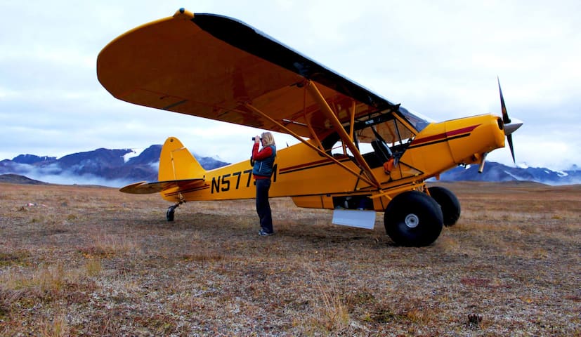
Scenic photography flights of the North Cascades. Often called “America’s Alps,” the mountain scenery of the North Cascades features dozens of glaciers, alpine lakes, and plunging waterfalls. Experience this world-class mountain scenery from the air.
https://snowkingaviation.com/
Snowking Aviation
7879 South Superior AvenueScenic photography flights of the North Cascades. Often called “America’s Alps,” the mountain scenery of the North Cascades features dozens of glaciers, alpine lakes, and plunging waterfalls. Experience this world-class mountain scenery from the air.
https://snowkingaviation.com/

52921 Rockport Park Rd
52921 Rockport Park RoadSkagit River Eagle Tours
https://skagiteagles.com/
Anacortes offers a ton of tours, including of Deception Pass and whale watching.
https://anacortes.org/business-category/adventure
71 persone del luogo consigliano

Anacortes
Anacortes offers a ton of tours, including of Deception Pass and whale watching.
https://anacortes.org/business-category/adventure
Fishing, Hiking, Birding, and Exploring
With over 300 glaciers, peaks, valleys, and cascading waterfalls, the North Cascades are fondly called the American Alps. The North Cascades National Park is in the eastern region of Skagit Valley. The North Cascades National Park and Forest Information Center, located in Sedro-Woolley, includes an exhibit map model of the park and adjacent national forests along with retail sales of books, maps, videos, and other items related to the North Cascades National Park.
The North Cascades Visitor Center is located across the Skagit River from the North Cascades Highway (State Route 20) near milepost 120 and the town of Newhalem. Learn about the park with the map model of the park, exhibit room featuring multimedia exhibits on the park’s natural and cultural history, and pick up a souvenir in the retail area.
Are you looking for a backcountry permit? Stop by the Wilderness Information Center in Marblemount (7280 Ranger Station Rd) at State Route 20 milepost 105.3. Inside find exhibits about wilderness and backcountry travel, map model, and sales of books, maps, and other items related to wilderness, hiking, and climbing. This center is the main backcountry permit office for North Cascades National Park and the adjacent Ross Lake and Lake Chelan National Recreation Areas. Backcountry permits are required year-round and are available at an outdoor self-issue station when the station closes during the winter season.
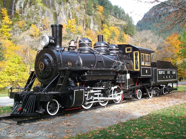
Looking to stretch out those legs, a quick restroom break, and a surprisingly fun exhibit, stop by the Skagit Information Center on State Route 20 in the town of Newhalem. Jointly operated by Seattle City Light, North Cascades Institute, and North Cascades National Park, learn about hydroelectric power and Skagit Project dams at the exhibit. Take the Trail of the Cedars short hike over the river and enjoy the forest. Also, the park at the Skagit Information Center is a great place to let the kids run around the steam engine while enjoying lunch in a majestic setting. Climb aboard Old Number Six, a restored Baldwin steam engine, and ring its big brass bell. Located next to the Skagit General Store, this locomotive used to run between Newhalem and Rockport and offered the only access to the area during construction of the Skagit River Project. Picnic tables, a playground, and restrooms are nearby.
74 persone del luogo consigliano
Parco nazionale delle North Cascades
With over 300 glaciers, peaks, valleys, and cascading waterfalls, the North Cascades are fondly called the American Alps. The North Cascades National Park is in the eastern region of Skagit Valley. The North Cascades National Park and Forest Information Center, located in Sedro-Woolley, includes an exhibit map model of the park and adjacent national forests along with retail sales of books, maps, videos, and other items related to the North Cascades National Park.
The North Cascades Visitor Center is located across the Skagit River from the North Cascades Highway (State Route 20) near milepost 120 and the town of Newhalem. Learn about the park with the map model of the park, exhibit room featuring multimedia exhibits on the park’s natural and cultural history, and pick up a souvenir in the retail area.
Are you looking for a backcountry permit? Stop by the Wilderness Information Center in Marblemount (7280 Ranger Station Rd) at State Route 20 milepost 105.3. Inside find exhibits about wilderness and backcountry travel, map model, and sales of books, maps, and other items related to wilderness, hiking, and climbing. This center is the main backcountry permit office for North Cascades National Park and the adjacent Ross Lake and Lake Chelan National Recreation Areas. Backcountry permits are required year-round and are available at an outdoor self-issue station when the station closes during the winter season.
Looking to stretch out those legs, a quick restroom break, and a surprisingly fun exhibit, stop by the Skagit Information Center on State Route 20 in the town of Newhalem. Jointly operated by Seattle City Light, North Cascades Institute, and North Cascades National Park, learn about hydroelectric power and Skagit Project dams at the exhibit. Take the Trail of the Cedars short hike over the river and enjoy the forest. Also, the park at the Skagit Information Center is a great place to let the kids run around the steam engine while enjoying lunch in a majestic setting. Climb aboard Old Number Six, a restored Baldwin steam engine, and ring its big brass bell. Located next to the Skagit General Store, this locomotive used to run between Newhalem and Rockport and offered the only access to the area during construction of the Skagit River Project. Picnic tables, a playground, and restrooms are nearby.
Great (dog friendly) place to spend the day on the lake or shore in view of both Mount Baker and Shuksun.
Lake Shannon Recreational Area
6323 Baker River RdGreat (dog friendly) place to spend the day on the lake or shore in view of both Mount Baker and Shuksun.
Magnificent old growth forests, stellar views of Mount Baker, turbulent tributaries, and, of course, a beautiful lake make this trail a great path to travel.
With two access points and multiple campsites, the full 14-mile Baker Lake Trail offers a remarkable wilderness experience for hikers of all ages and abilities. The trail can accommodate a range of hiking interests, from short day hikes to overnight backpacking excursions. And thanks to the trail’s low elevation, it is accessible even when most other Cascadian trails are buried under snow.
The trail flanks the eastern edge of Baker Lake, created by the 1959 damming of the Baker River. Starting from either the north or south trailhead, hikers will encounter a forest of maturing Douglas firs. Cedar used to dominate, but the 1843 eruption of Mount Baker triggered a forest fire, reducing the old-growth cedars to burnt snags.
Cedar remains among the towering firs provide evidence of this historical event. Along the trail, foliage, fungus, lichen and moss never fail to impress. Mushrooms dot the forest floor allowing hikers to forage for fabulous fungus as they traipse through the woods, and the towering trees draped with old man’s beard provide shelter from the drizzly mist that accompanies most winter hikes in the Northwest.
Numerous cascading creeks cross the trail as they make their way from the mountains above to the lake water below. Sturdy bridges span these tributaries keeping your feet dry and your brain pondering how a trail crew could build such a strong structure in the wilderness. Most impressive of all is the suspension bridge over the rushing Baker River, just a half-mile from the northern trailhead. (To hike this trail from the northern trailhead, see our East Bank Baker Lake entry).
Located intermittently along the trail, several campgrounds provide a temporary homestead for backpackers and logical turnaround point for day hikers. All camping areas are complete with fire pits and vault or backcountry toilets.
A wonderful trail for getting outdoors in the midst of winter (without snowshoes or skis), the Baker Lake Trail makes a marvelous wilderness escape any time of year.
https://www.wta.org/go-hiking/hikes/baker-lake-maple-grove
6 persone del luogo consigliano
Baker Lake Trail
Baker Lake RoadMagnificent old growth forests, stellar views of Mount Baker, turbulent tributaries, and, of course, a beautiful lake make this trail a great path to travel.
With two access points and multiple campsites, the full 14-mile Baker Lake Trail offers a remarkable wilderness experience for hikers of all ages and abilities. The trail can accommodate a range of hiking interests, from short day hikes to overnight backpacking excursions. And thanks to the trail’s low elevation, it is accessible even when most other Cascadian trails are buried under snow.
The trail flanks the eastern edge of Baker Lake, created by the 1959 damming of the Baker River. Starting from either the north or south trailhead, hikers will encounter a forest of maturing Douglas firs. Cedar used to dominate, but the 1843 eruption of Mount Baker triggered a forest fire, reducing the old-growth cedars to burnt snags.
Cedar remains among the towering firs provide evidence of this historical event. Along the trail, foliage, fungus, lichen and moss never fail to impress. Mushrooms dot the forest floor allowing hikers to forage for fabulous fungus as they traipse through the woods, and the towering trees draped with old man’s beard provide shelter from the drizzly mist that accompanies most winter hikes in the Northwest.
Numerous cascading creeks cross the trail as they make their way from the mountains above to the lake water below. Sturdy bridges span these tributaries keeping your feet dry and your brain pondering how a trail crew could build such a strong structure in the wilderness. Most impressive of all is the suspension bridge over the rushing Baker River, just a half-mile from the northern trailhead. (To hike this trail from the northern trailhead, see our East Bank Baker Lake entry).
Located intermittently along the trail, several campgrounds provide a temporary homestead for backpackers and logical turnaround point for day hikers. All camping areas are complete with fire pits and vault or backcountry toilets.
A wonderful trail for getting outdoors in the midst of winter (without snowshoes or skis), the Baker Lake Trail makes a marvelous wilderness escape any time of year.
https://www.wta.org/go-hiking/hikes/baker-lake-maple-grove
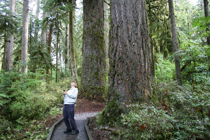
This interpretive trail is a great one for visitors of all ages. Thanks to the boardwalk, it's great for all comers, including those with mobility issues. Educational signs found along the trail illustrate the purpose of our forests and the reason we need to preserve them.
The trail’s dedicated parking area and a large wooden sign makes it easy to spot, just on the right-hand side of Baker Lake Road. Upon beginning your hike, you’ll see that a large portion of this trail is a boardwalk to help preserve the ecosystem and to allow for those visiting with strollers or wheelchairs to enjoy the area.
And there’s much to enjoy. Gaze in awe up the massive trunks of old-growth Douglas-firs, Western red cedars and others giants along this trail. Some of the trees are estimated to be nearly 700 years old! Read the interpretive signs to get a better sense of the area, and imagine what these trees could tell you if they could talk.
Springtime should give you unobstructed access to this trail and when you’re done here, head on up the road to its end and find several other longer, but relatively easy hikes to do in the same day.
WTA Pro Tip: In winter, the trailhead is a Sno-Park, infrequently plowed and rendering the trail impassable for wheelchairs or strollers. While this trail is at a low elevation, its nestled into the Cascade mountain range and snow can stick around well into spring. Read trip reports to figure out if you’ll need to prepare for snow during your visit.
https://www.wta.org/go-hiking/hikes/shadow-of-the-sentinels
Shadow of the Sentinels Interpretive Site
National Forest Development Road 11This interpretive trail is a great one for visitors of all ages. Thanks to the boardwalk, it's great for all comers, including those with mobility issues. Educational signs found along the trail illustrate the purpose of our forests and the reason we need to preserve them.
The trail’s dedicated parking area and a large wooden sign makes it easy to spot, just on the right-hand side of Baker Lake Road. Upon beginning your hike, you’ll see that a large portion of this trail is a boardwalk to help preserve the ecosystem and to allow for those visiting with strollers or wheelchairs to enjoy the area.
And there’s much to enjoy. Gaze in awe up the massive trunks of old-growth Douglas-firs, Western red cedars and others giants along this trail. Some of the trees are estimated to be nearly 700 years old! Read the interpretive signs to get a better sense of the area, and imagine what these trees could tell you if they could talk.
Springtime should give you unobstructed access to this trail and when you’re done here, head on up the road to its end and find several other longer, but relatively easy hikes to do in the same day.
WTA Pro Tip: In winter, the trailhead is a Sno-Park, infrequently plowed and rendering the trail impassable for wheelchairs or strollers. While this trail is at a low elevation, its nestled into the Cascade mountain range and snow can stick around well into spring. Read trip reports to figure out if you’ll need to prepare for snow during your visit.
https://www.wta.org/go-hiking/hikes/shadow-of-the-sentinels
Rasar State Park, along the Wild and Scenic Skagit River, presents a variety of trails for exploring the park’s second-growth forest, native wildlife and pioneer history.
To experience the best the park has to offer, link the Skagit Woods Trail, the Skagit River Trail and the Field Trail for a looping, three mile nature walk. The Skagit Woods Trail takes hikers from the main campground, through second-growth forest, to the rocky, sandy shore of the river. The shoreline along the River Trail affords prime bird-watching opportunities. Next, traverse a grassy meadow on the Field Trail, where deer are frequently spotted grazing.
Views of Sauk Mountain are possible on clear days from the Field Trail, a mowed path which returns you to the impeccably groomed, large campground. Many small trails branch off the two main routes for exploring, making this a great campsite for kids and families.
The campsite includes a great play area and a large covered picnic area with kitchen. There are Junior Ranger programs offered on the weekends. This is a very nice park for all ages.
https://www.wta.org/go-hiking/hikes/rasar-state-park
Parco Statale di Rasar
38730 Cape Horn RdRasar State Park, along the Wild and Scenic Skagit River, presents a variety of trails for exploring the park’s second-growth forest, native wildlife and pioneer history.
To experience the best the park has to offer, link the Skagit Woods Trail, the Skagit River Trail and the Field Trail for a looping, three mile nature walk. The Skagit Woods Trail takes hikers from the main campground, through second-growth forest, to the rocky, sandy shore of the river. The shoreline along the River Trail affords prime bird-watching opportunities. Next, traverse a grassy meadow on the Field Trail, where deer are frequently spotted grazing.
Views of Sauk Mountain are possible on clear days from the Field Trail, a mowed path which returns you to the impeccably groomed, large campground. Many small trails branch off the two main routes for exploring, making this a great campsite for kids and families.
The campsite includes a great play area and a large covered picnic area with kitchen. There are Junior Ranger programs offered on the weekends. This is a very nice park for all ages.
https://www.wta.org/go-hiking/hikes/rasar-state-park
The family friendly trails of 670-acre Rockport State Park explore an ancient forest where dappled sunlight illuminates mossy trees and lush ferns -- perfect for a springtime stroll.
From the parking area, the 3-mile Evergreen Trail starts just beyond the restrooms and maintains a mostly easy grade with the only significant climbing along the top of the loop. The well-signed path will keep you going in the right direction when you encounter creeks and service roads. As you hike, notice the rich forest floor, where hidden organisms are recycling downed organic material into nutrients for new plants and food for local wildlife. Then cast your view skyward to the many towering red cedar and Douglas-fir trees, some reaching heights of more than 250 feet.
Along the trail you will cross several quaint wooden bridges where numerous creeks flow down through the park from the top of 5,537-foot Sauk Mountain, which stays snow-covered into late July. Take advantage of one of the many benches to rest and contemplate the variety of dense flora surrounding you. You just may feel as if you've been transported to a primeval forest due to the limited sunlight streaming down through the forest canopy above. For more, add on the 0.5 mile Fern Creek Trail, a mini-loop in the center of the park where some of the area's largest trees can be seen.
https://www.wta.org/go-hiking/hikes/rockport-state-park
6 persone del luogo consigliano
Rockport State Park
51905 State Route 20The family friendly trails of 670-acre Rockport State Park explore an ancient forest where dappled sunlight illuminates mossy trees and lush ferns -- perfect for a springtime stroll.
From the parking area, the 3-mile Evergreen Trail starts just beyond the restrooms and maintains a mostly easy grade with the only significant climbing along the top of the loop. The well-signed path will keep you going in the right direction when you encounter creeks and service roads. As you hike, notice the rich forest floor, where hidden organisms are recycling downed organic material into nutrients for new plants and food for local wildlife. Then cast your view skyward to the many towering red cedar and Douglas-fir trees, some reaching heights of more than 250 feet.
Along the trail you will cross several quaint wooden bridges where numerous creeks flow down through the park from the top of 5,537-foot Sauk Mountain, which stays snow-covered into late July. Take advantage of one of the many benches to rest and contemplate the variety of dense flora surrounding you. You just may feel as if you've been transported to a primeval forest due to the limited sunlight streaming down through the forest canopy above. For more, add on the 0.5 mile Fern Creek Trail, a mini-loop in the center of the park where some of the area's largest trees can be seen.
https://www.wta.org/go-hiking/hikes/rockport-state-park
Baker River Kayak Launch
Boat access to the Skagit.
The Skagit River hosts one of the largest populations of wintering bald eagles in the continental US, and you can look for them perched in the trees along the river searching for a meal of salmon. Besides the eagles, the Skagit here is designated a Wild and Scenic River, making this short walk a particularly lovely one.
Find the trail sign and kiosk with a map of the trail. The trail follows along the bank where the Cascade River meets the Skagit River. First walk alongside the Skagit River. There is plenty of river access all along this flat trail for watching for eagles or throwing rocks in the water. Where the two rivers come together, there is a path leading to a nice bench with a view. The trail makes a bend and now follows alongside the Cascade River.
This area once was a grassy field, it was replanted with cedar and Douglas fir several years ago and it now becoming woods instead of a field. The trail is a bit further away from the river now, but there are side paths that lead down to the river, be sure and take one, the view up the Cascade River valley to the snow- covered peaks beyond is spectacular! The trail just ends at a gate by the road, turn around and head back the way you came.
https://www.wta.org/go-hiking/hikes/marblemount-boat-launch-trail
Marblemount Boat launch
5872 Cascade River RoadThe Skagit River hosts one of the largest populations of wintering bald eagles in the continental US, and you can look for them perched in the trees along the river searching for a meal of salmon. Besides the eagles, the Skagit here is designated a Wild and Scenic River, making this short walk a particularly lovely one.
Find the trail sign and kiosk with a map of the trail. The trail follows along the bank where the Cascade River meets the Skagit River. First walk alongside the Skagit River. There is plenty of river access all along this flat trail for watching for eagles or throwing rocks in the water. Where the two rivers come together, there is a path leading to a nice bench with a view. The trail makes a bend and now follows alongside the Cascade River.
This area once was a grassy field, it was replanted with cedar and Douglas fir several years ago and it now becoming woods instead of a field. The trail is a bit further away from the river now, but there are side paths that lead down to the river, be sure and take one, the view up the Cascade River valley to the snow- covered peaks beyond is spectacular! The trail just ends at a gate by the road, turn around and head back the way you came.
https://www.wta.org/go-hiking/hikes/marblemount-boat-launch-trail
Enjoy beautiful views, quiet forest and wildlife activity on this peaceful trail, perfect in spring or on a crisp and clear day in winter.
The trails leaving from this site are generally known as the Wetland Wildlife Trail, and offer a variety of ways to enjoy this beautiful place. One option is to head out from the farthest campsite at the Howard Miller Steelhead County Park onto a trail that in a wetland.
The trail follows an old railroad grade and skirts a swampy area where you might see beaver activity if you pay close attention. There are also informational boards on salmon and eagles. It is possible to create quite a long loop on this trail network. By staying on the main trail nearest the river, hikers will eventually connect with the Skagit-Sauk Reach trail, which leads back to the campground.
For a shorter outing, turn right (following a sign that points to a dead end) at a T intersection. You can meander as far as you like down this branch of trail, but it's possible go almost 5 miles this way.
https://www.wta.org/go-hiking/hikes/howard-miller-steelhead-park-rail-trail
6 persone del luogo consigliano
Howard Miller Steelhead Park
52804 Rockport Park RdEnjoy beautiful views, quiet forest and wildlife activity on this peaceful trail, perfect in spring or on a crisp and clear day in winter.
The trails leaving from this site are generally known as the Wetland Wildlife Trail, and offer a variety of ways to enjoy this beautiful place. One option is to head out from the farthest campsite at the Howard Miller Steelhead County Park onto a trail that in a wetland.
The trail follows an old railroad grade and skirts a swampy area where you might see beaver activity if you pay close attention. There are also informational boards on salmon and eagles. It is possible to create quite a long loop on this trail network. By staying on the main trail nearest the river, hikers will eventually connect with the Skagit-Sauk Reach trail, which leads back to the campground.
For a shorter outing, turn right (following a sign that points to a dead end) at a T intersection. You can meander as far as you like down this branch of trail, but it's possible go almost 5 miles this way.
https://www.wta.org/go-hiking/hikes/howard-miller-steelhead-park-rail-trail
This county park consists of 40 acres of old homestead land in Marblemount. The park is for day use only and includes a picnic shelter, fishing and hiking trails. The aptly named Birding Trail, opened in 2003, that runs around the perimeter of the park is a great place to look for bald eagles and other beautiful birds.
https://www.wta.org/go-hiking/hikes/pressentin-park
Pressentin Park
60060 State Route 20This county park consists of 40 acres of old homestead land in Marblemount. The park is for day use only and includes a picnic shelter, fishing and hiking trails. The aptly named Birding Trail, opened in 2003, that runs around the perimeter of the park is a great place to look for bald eagles and other beautiful birds.
https://www.wta.org/go-hiking/hikes/pressentin-park
Extending from the family-friendly Wetland Wildlife Interpretive Trail at Howard Miller Steelhead Park, the Skagit–Sauk Reach Trail stretches toward the confluence of the Skagit and Sauk Rivers before looping back toward the camping area at the park.
The gentle terrain of this trail offers access to the banks of the Wild and Scenic Skagit River, mountain views and prime bird-watching opportunities. Begin by exploring the short interpretive loop, where informational signs highlight the area’s wildlife and plant life and the important relationship between the two.
From the loop’s far end, continue west through the grassy, wooded landscape, where spur trails lead to the banks of the river. From the shoreline, cast your gaze upward, toward the trees; you’ll likely spot bald eagles perched above the river.
The path leads north, then east, as the loop makes its way back to its starting point, skirting the boundary between an open, grassy meadow and a stand of deciduous trees. Keep your eyes peeled for deer grazing in the grass and for birds, such as hawks and ravens, soaring overhead.
https://www.wta.org/go-hiking/hikes/skagit-sauk-reach-trail
Skagit-Sauk Reach Trail
Extending from the family-friendly Wetland Wildlife Interpretive Trail at Howard Miller Steelhead Park, the Skagit–Sauk Reach Trail stretches toward the confluence of the Skagit and Sauk Rivers before looping back toward the camping area at the park.
The gentle terrain of this trail offers access to the banks of the Wild and Scenic Skagit River, mountain views and prime bird-watching opportunities. Begin by exploring the short interpretive loop, where informational signs highlight the area’s wildlife and plant life and the important relationship between the two.
From the loop’s far end, continue west through the grassy, wooded landscape, where spur trails lead to the banks of the river. From the shoreline, cast your gaze upward, toward the trees; you’ll likely spot bald eagles perched above the river.
The path leads north, then east, as the loop makes its way back to its starting point, skirting the boundary between an open, grassy meadow and a stand of deciduous trees. Keep your eyes peeled for deer grazing in the grass and for birds, such as hawks and ravens, soaring overhead.
https://www.wta.org/go-hiking/hikes/skagit-sauk-reach-trail
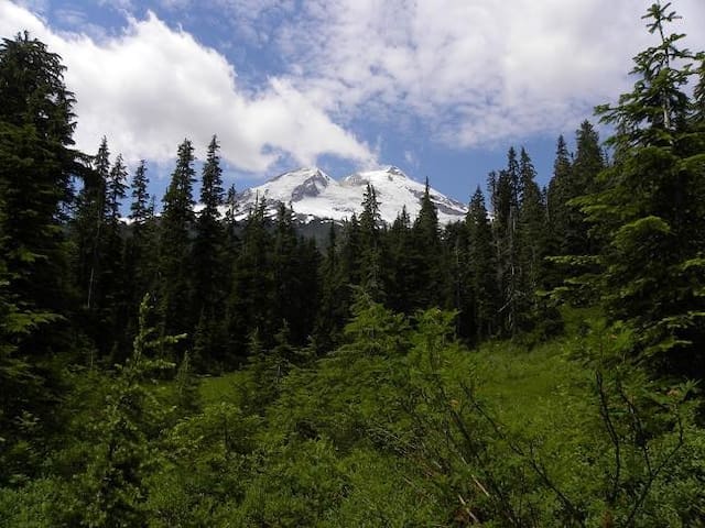
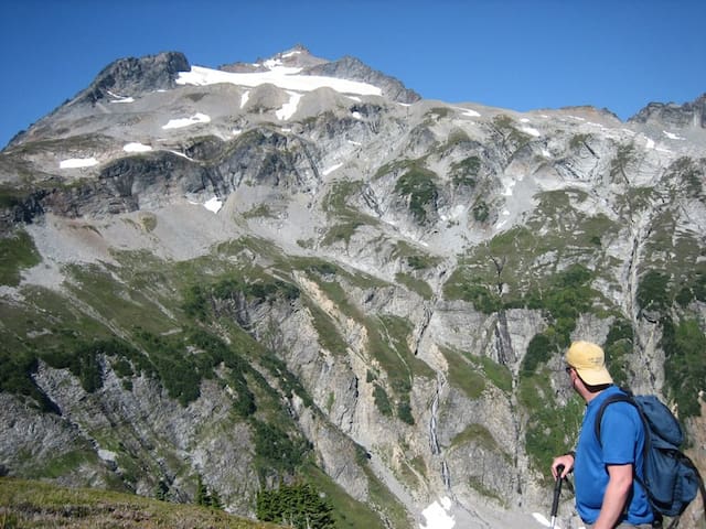
Short but steep, this trail delivers excellent views of Mount Baker, Mount Shuksan, and Anderson Butte. Similar views can be had from the road to the trailhead, but taking this hike offers solitude-even a hiker’s high-from climbing steeply away from the road and into the mountains.
Begin hiking through a beautiful forest. After approximately a mile, arrive in a pretty meadow and find a well-marked junction. Head left, and very quickly find another marked junction. The sign for this one is held together with a bungee cord. The trail to Anderson Butte heads right, crossing a boggy area on a broken log that has been notched for improved traction.
Climb steeply through shaded forest, ascending 600 feet in half a mile! Toward the end, you’ll get views of Anderson Butte and the valley below. A few blueberries may provide a little morale boost as you make your way to the site of the former lookout tower. Enjoy excellent views of Mount Baker and Mount Shuksan from this small craggy perch.
On your way back down, consider a short side-trip to Anderson or Watson Lakes. After that steep climb, a quick dip would feel pretty good.
https://www.wta.org/go-hiking/hikes/anderson-butte
Anderson Butte
Short but steep, this trail delivers excellent views of Mount Baker, Mount Shuksan, and Anderson Butte. Similar views can be had from the road to the trailhead, but taking this hike offers solitude-even a hiker’s high-from climbing steeply away from the road and into the mountains.
Begin hiking through a beautiful forest. After approximately a mile, arrive in a pretty meadow and find a well-marked junction. Head left, and very quickly find another marked junction. The sign for this one is held together with a bungee cord. The trail to Anderson Butte heads right, crossing a boggy area on a broken log that has been notched for improved traction.
Climb steeply through shaded forest, ascending 600 feet in half a mile! Toward the end, you’ll get views of Anderson Butte and the valley below. A few blueberries may provide a little morale boost as you make your way to the site of the former lookout tower. Enjoy excellent views of Mount Baker and Mount Shuksan from this small craggy perch.
On your way back down, consider a short side-trip to Anderson or Watson Lakes. After that steep climb, a quick dip would feel pretty good.
https://www.wta.org/go-hiking/hikes/anderson-butte
This trail features plenty of variety, with destinations spaced perfectly for families or first-time backpackers. Beautiful hemlock forest, meadows dotted with wildflowers, gleaming lakes, mountain views, juicy berries and excellent camping are all available. Wait until later in the hiking season though, as this area is known for its bugs.
Begin hiking through a beautiful forest of second-growth hemlock. Boardwalks help keep your feet dry and add interest for younger hikers. After approximately a mile of hiking, arrive in a pretty meadow, where you'll find a signed junction for Anderson Butte. This 1.5 mile side trip is a steep hike, but well-shaded, and worth the sweat expended to achieve the summit, offering views of Mounts Baker and Shuksan.
Take the side trip if you like, or continue right, though the meadow where several varieties of wildflowers bloom in August. Cross a small stream, and climb gradually up the meadow. Look behind you periodically, there is an excellent view of Mount Baker.
At the top of the meadow, enter a beautiful forest draped in moss. Descend steeply, taking note that you’ll have to climb this on the way back to your car. At least the trail is well-shaded. At 1.5 miles from the trailhead, arrive at another meadow and another junction.
The trail to the right heads half a mile downhill to lower Anderson Lake; a small lake surrounded by grassy meadows and an interesting wall of rocky gray pinnacles. Camping and a backcountry privy are available here.
The trail to the left continues 1.5 miles to Watson Lakes. It climbs briefly and then drops down to the lakes, crossing into the Noisy-Diobsud Wilderness along the way. The first lake is pretty and a worthwhile place to stop and have a snack. Camping is available, but it is not especially private.
Extending Your Trip: For a more rugged experience, continue on to Upper Watson Lake, the more dramatic of the two. The shoreline and the walls are much rockier, distant mountains come into view, and the berries are prolific. The camping is also much better–several sites are located on rock outcroppings along the lake shore. A backcountry privy is available. Take your time to enjoy the scenery–your return hike is only 3 miles long.
https://www.wta.org/go-hiking/hikes/anderson-and-watson-lakes
Watson Lakes
This trail features plenty of variety, with destinations spaced perfectly for families or first-time backpackers. Beautiful hemlock forest, meadows dotted with wildflowers, gleaming lakes, mountain views, juicy berries and excellent camping are all available. Wait until later in the hiking season though, as this area is known for its bugs.
Begin hiking through a beautiful forest of second-growth hemlock. Boardwalks help keep your feet dry and add interest for younger hikers. After approximately a mile of hiking, arrive in a pretty meadow, where you'll find a signed junction for Anderson Butte. This 1.5 mile side trip is a steep hike, but well-shaded, and worth the sweat expended to achieve the summit, offering views of Mounts Baker and Shuksan.
Take the side trip if you like, or continue right, though the meadow where several varieties of wildflowers bloom in August. Cross a small stream, and climb gradually up the meadow. Look behind you periodically, there is an excellent view of Mount Baker.
At the top of the meadow, enter a beautiful forest draped in moss. Descend steeply, taking note that you’ll have to climb this on the way back to your car. At least the trail is well-shaded. At 1.5 miles from the trailhead, arrive at another meadow and another junction.
The trail to the right heads half a mile downhill to lower Anderson Lake; a small lake surrounded by grassy meadows and an interesting wall of rocky gray pinnacles. Camping and a backcountry privy are available here.
The trail to the left continues 1.5 miles to Watson Lakes. It climbs briefly and then drops down to the lakes, crossing into the Noisy-Diobsud Wilderness along the way. The first lake is pretty and a worthwhile place to stop and have a snack. Camping is available, but it is not especially private.
Extending Your Trip: For a more rugged experience, continue on to Upper Watson Lake, the more dramatic of the two. The shoreline and the walls are much rockier, distant mountains come into view, and the berries are prolific. The camping is also much better–several sites are located on rock outcroppings along the lake shore. A backcountry privy is available. Take your time to enjoy the scenery–your return hike is only 3 miles long.
https://www.wta.org/go-hiking/hikes/anderson-and-watson-lakes
This trail is a rarely traveled and quite rustic trail used primarily by climbers as an alternate climbing route for Mount Baker. The trail starts in timber and is sometimes brushy and a little muddy. At 2 miles the trail enters wilderness and is not maintained as it climbs through increasingly poor, muddy and rooty tread past numerous waterfalls.
At nearly 4 miles, climb through the moraine to the base of a cliff at Boulder Ridge. Sometimes there is a rope you can use to scramble up the lava cliffs or find a route and climb to the top.
At the top of the ridge, expansive views of Mount Baker and the Boulder Glacier await you as you traverse through open meadows. Though not for the faint of heart, this hike has a truly spectacular payoff in views and provides a solitary hiking experience.
https://www.wta.org/go-hiking/hikes/boulder-ridge
Boulder Ridge Trailhead
National Forest Development Road 1131This trail is a rarely traveled and quite rustic trail used primarily by climbers as an alternate climbing route for Mount Baker. The trail starts in timber and is sometimes brushy and a little muddy. At 2 miles the trail enters wilderness and is not maintained as it climbs through increasingly poor, muddy and rooty tread past numerous waterfalls.
At nearly 4 miles, climb through the moraine to the base of a cliff at Boulder Ridge. Sometimes there is a rope you can use to scramble up the lava cliffs or find a route and climb to the top.
At the top of the ridge, expansive views of Mount Baker and the Boulder Glacier await you as you traverse through open meadows. Though not for the faint of heart, this hike has a truly spectacular payoff in views and provides a solitary hiking experience.
https://www.wta.org/go-hiking/hikes/boulder-ridge
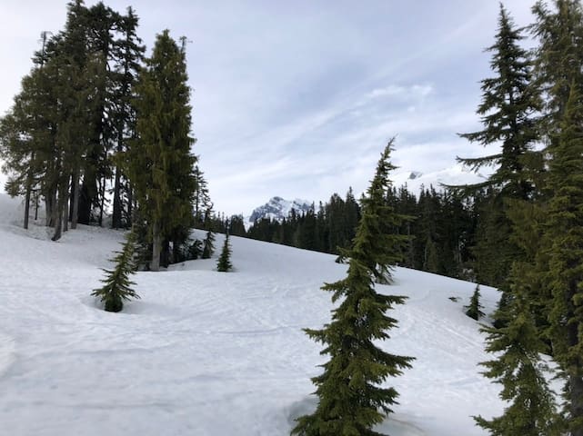
Schriebers Meadow is a popular hiking destination in the summer and fall, but it becomes a true winter wonderland in the snowy months. With magnificent Mount Baker towering above the rolling snowfields of the alpine meadows, there is plenty of room to roam and take in the scenery. However, be prepared to share the trail with both snowmobilers and cross-country skiers. Practice good trail etiquette by staying out of ski tracks and listening for approaching snowmobiles so you can stay safely out of the way.
From the Sno-Park, make your way up snow-covered Forest Road 13. For five miles climb gently under a canopy of trees as the wide roadway makes its way along a hillside above Sulphur Creek. Eventually the road ends at the summer trailhead for the Mount Baker National Recreation Area.
From the expansive summer parking area, the trail narrows as it crosses Sulphur Creek and reaches the edge of Schriebers Meadow. From here, feel free to explore to your heart’s content, finding a space away from the crowds to enjoy lunch or set up camp.
If you have enough energy left and are confident in your navigation and snow travel skills, consider pushing onward toward Survey Point, which offers views of not only Mount Baker, but also Park and Black buttes and Schriebers Meadow below. This point lies northwest of Schriebers Meadow and should only be attempted if you have the experience and skills to select a safe route and know how to read avalanche terrain and conditions. Otherwise continue to enjoy the meadow before heading back.
https://www.wta.org/go-hiking/hikes/schriebers-meadow-snowshoe
Schriebers Meadow
Schriebers Meadow is a popular hiking destination in the summer and fall, but it becomes a true winter wonderland in the snowy months. With magnificent Mount Baker towering above the rolling snowfields of the alpine meadows, there is plenty of room to roam and take in the scenery. However, be prepared to share the trail with both snowmobilers and cross-country skiers. Practice good trail etiquette by staying out of ski tracks and listening for approaching snowmobiles so you can stay safely out of the way.
From the Sno-Park, make your way up snow-covered Forest Road 13. For five miles climb gently under a canopy of trees as the wide roadway makes its way along a hillside above Sulphur Creek. Eventually the road ends at the summer trailhead for the Mount Baker National Recreation Area.
From the expansive summer parking area, the trail narrows as it crosses Sulphur Creek and reaches the edge of Schriebers Meadow. From here, feel free to explore to your heart’s content, finding a space away from the crowds to enjoy lunch or set up camp.
If you have enough energy left and are confident in your navigation and snow travel skills, consider pushing onward toward Survey Point, which offers views of not only Mount Baker, but also Park and Black buttes and Schriebers Meadow below. This point lies northwest of Schriebers Meadow and should only be attempted if you have the experience and skills to select a safe route and know how to read avalanche terrain and conditions. Otherwise continue to enjoy the meadow before heading back.
https://www.wta.org/go-hiking/hikes/schriebers-meadow-snowshoe
A popular trail with great views of the Sauk and Skagit River valleys, Cascade mountain peaks, and on a good clear day, the Olympics and San Juan Islands. There will also be plenty of wildflowers to please photographers and hiking plant nerds alike.
There is something to see every step of the way on this hike; the views start as soon as you open your car door at the trailhead. The trail takes off from the parking lot past a cute little A-frame outhouse, then traverses along the base of the mountain before starting a series of switchbacks upward across the meadow.
The way is steep and narrow, and in some places eroded from hikers cutting the switchbacks. Please don’t, the switchbacks are there to prevent erosion and environmental damage to the trail. As you hike, the views get even better, so go ahead, stop for a breather, and take a few pictures. The trail is south-facing and exposed to the sun, so be sure to take plenty of breaks and enjoy your view.
Notice too, that the flower species changing as you climb. Leave the oxeye daisy (a non-native) and native thistles behind as you climb through fireweed, cow parsnip and valerian. Soon, purple penstemon, paintbrush and pearly everlasting line the trail. Look for the lacy leaves and flowers of Western meadowrue. Did you know the male and female flowers are on different plants? The male plants have flowers with long showy stamens hanging down. You may pass by a dark purple-black small daisylike flower and wonder what it is. It goes by the name sawwort (Saussurea). Later in the season look for purple asters, Scottish bluebell and yarrow.
Climb higher and rest in the shade of small groves of subalpine fir and hemlock at the edge of the switchbacks. Listen for marmots and watch for their holes. Mount Baker will be peeking out from behind the ridge, and the Skagit and Sauk river valleys will be below. On a clear day, you can see the water of Puget Sound.
In just over a mile the trail crosses a small saddle in the ridgeline and heads north. Look for Glacier Peak and the mountains of the North Cascades spread before you! Early in the season, the snow may start here. If it has just melted, notice the glacier lilies and spring beauty left in its wake. Circle around the north side and there will be an intersecting trail to the right leading downhill. This leads to Sauk Lake, losing more elevation than you gained from the parking lot. There will be little trails leading over the ridge to viewpoints, but stay on the main trail, as you want the Big Picture at the top.
Swing around the hill and come to a flat spot by a nice grove of trees. Look over the edge and see Sauk Lake. From here the trail to the top will be visible below the rock pinnacles. Early in the season, this section of the trail may be covered with snowfields. Cross carefully, or enjoy your lunch from the trees and save the rest for later. If the snow is gone, follow the trail through the rocks. Notice the small alpine flowers, saxifrage, potentilla, thyme buckwheat and yellow coralbells. Clinging to the rocks is a large shrubby grey-leafed plant with odd looking creamy flower clusters called silverback luina.
The trail can be a little hard to follow at the top, but look for worn tread in a saddle between the rocks, cross over and make your way to the lookout site at the top. Soak in the views and try to name all the peaks, a sea of peaks, near and far. The Pickets are obvious, as is Whitehorse Mountain near Darrington, Glacier Peak and over to the south, Rainier. You may see Mount Constitution on Orcas Island. There once was a fire lookout here and you can still see some debris from it at the summit. On a nice sunny weekend it can get crowded up here, so eat your lunch, take your pictures and head down so someone else can enjoy it.
WTA Pro-Tip: Use the National Geographic North Cascades National Park map for peak identification from the summit; it covers more of this territory than Green Trails.
https://www.wta.org/go-hiking/hikes/sauk-mountain
Sauk Mountain Trailhead
National Forest Development Road 1030A popular trail with great views of the Sauk and Skagit River valleys, Cascade mountain peaks, and on a good clear day, the Olympics and San Juan Islands. There will also be plenty of wildflowers to please photographers and hiking plant nerds alike.
There is something to see every step of the way on this hike; the views start as soon as you open your car door at the trailhead. The trail takes off from the parking lot past a cute little A-frame outhouse, then traverses along the base of the mountain before starting a series of switchbacks upward across the meadow.
The way is steep and narrow, and in some places eroded from hikers cutting the switchbacks. Please don’t, the switchbacks are there to prevent erosion and environmental damage to the trail. As you hike, the views get even better, so go ahead, stop for a breather, and take a few pictures. The trail is south-facing and exposed to the sun, so be sure to take plenty of breaks and enjoy your view.
Notice too, that the flower species changing as you climb. Leave the oxeye daisy (a non-native) and native thistles behind as you climb through fireweed, cow parsnip and valerian. Soon, purple penstemon, paintbrush and pearly everlasting line the trail. Look for the lacy leaves and flowers of Western meadowrue. Did you know the male and female flowers are on different plants? The male plants have flowers with long showy stamens hanging down. You may pass by a dark purple-black small daisylike flower and wonder what it is. It goes by the name sawwort (Saussurea). Later in the season look for purple asters, Scottish bluebell and yarrow.
Climb higher and rest in the shade of small groves of subalpine fir and hemlock at the edge of the switchbacks. Listen for marmots and watch for their holes. Mount Baker will be peeking out from behind the ridge, and the Skagit and Sauk river valleys will be below. On a clear day, you can see the water of Puget Sound.
In just over a mile the trail crosses a small saddle in the ridgeline and heads north. Look for Glacier Peak and the mountains of the North Cascades spread before you! Early in the season, the snow may start here. If it has just melted, notice the glacier lilies and spring beauty left in its wake. Circle around the north side and there will be an intersecting trail to the right leading downhill. This leads to Sauk Lake, losing more elevation than you gained from the parking lot. There will be little trails leading over the ridge to viewpoints, but stay on the main trail, as you want the Big Picture at the top.
Swing around the hill and come to a flat spot by a nice grove of trees. Look over the edge and see Sauk Lake. From here the trail to the top will be visible below the rock pinnacles. Early in the season, this section of the trail may be covered with snowfields. Cross carefully, or enjoy your lunch from the trees and save the rest for later. If the snow is gone, follow the trail through the rocks. Notice the small alpine flowers, saxifrage, potentilla, thyme buckwheat and yellow coralbells. Clinging to the rocks is a large shrubby grey-leafed plant with odd looking creamy flower clusters called silverback luina.
The trail can be a little hard to follow at the top, but look for worn tread in a saddle between the rocks, cross over and make your way to the lookout site at the top. Soak in the views and try to name all the peaks, a sea of peaks, near and far. The Pickets are obvious, as is Whitehorse Mountain near Darrington, Glacier Peak and over to the south, Rainier. You may see Mount Constitution on Orcas Island. There once was a fire lookout here and you can still see some debris from it at the summit. On a nice sunny weekend it can get crowded up here, so eat your lunch, take your pictures and head down so someone else can enjoy it.
WTA Pro-Tip: Use the National Geographic North Cascades National Park map for peak identification from the summit; it covers more of this territory than Green Trails.
https://www.wta.org/go-hiking/hikes/sauk-mountain
This 22.5-mile rail trail follows the abandoned Burlington Northern grade connecting the towns of Sedro Woolley and Concrete, and can be accessed from three trailheads off of the North Cascades Highway.
The trail from Sedro Woolley starts in the fertile farmland of the Skagit Valley to the south of the North Cascades Highway. The route meanders back and forth between the Skagit River and the highway, sometimes closer to the river, other times right next to the highway, but always with scenic views of farmland and foothills. In winter one can see tundra swans and snow geese poking about in the fields. Near Lyman, the trail hugs the banks of the Skagit before the river begins a southerly meander. At Hamilton, users pass near log yards and over backwater sloughs where one can spy blue herons, red-winged blackbirds and kingfishers.
Just east of Hamilton, the trail crosses the North Cascades Highway and continues its travels on the north side of the valley. The bit of elevation gain on the trail occurs here, as the trail ascends to traverse forested slopes above the banks of the Skagit River as it meanders back north. One can spy eagles along the river, or look east to Sauk Mountain and peekaboo views of peaks of the North Cascades.
Near milepost 19 the trail passes through land designated to protect the Skagit River population of the North Cascades elk herd. Here, elk trails crisscross the grade, and Hurn Field, the meadow they call home, is visible below. Shortly thereafter, one comes to a small park recently built by Skagit County Parks. It abuts Challenger Ridge Winery. One can either have a picnic lunch and enjoy the small fish pond or wander down to the winery for such wonders as wood-fired pizza, chowders and wine tasting.
https://www.wta.org/go-hiking/hikes/cascade-trail
Cascade Trail
Cascade TrailThis 22.5-mile rail trail follows the abandoned Burlington Northern grade connecting the towns of Sedro Woolley and Concrete, and can be accessed from three trailheads off of the North Cascades Highway.
The trail from Sedro Woolley starts in the fertile farmland of the Skagit Valley to the south of the North Cascades Highway. The route meanders back and forth between the Skagit River and the highway, sometimes closer to the river, other times right next to the highway, but always with scenic views of farmland and foothills. In winter one can see tundra swans and snow geese poking about in the fields. Near Lyman, the trail hugs the banks of the Skagit before the river begins a southerly meander. At Hamilton, users pass near log yards and over backwater sloughs where one can spy blue herons, red-winged blackbirds and kingfishers.
Just east of Hamilton, the trail crosses the North Cascades Highway and continues its travels on the north side of the valley. The bit of elevation gain on the trail occurs here, as the trail ascends to traverse forested slopes above the banks of the Skagit River as it meanders back north. One can spy eagles along the river, or look east to Sauk Mountain and peekaboo views of peaks of the North Cascades.
Near milepost 19 the trail passes through land designated to protect the Skagit River population of the North Cascades elk herd. Here, elk trails crisscross the grade, and Hurn Field, the meadow they call home, is visible below. Shortly thereafter, one comes to a small park recently built by Skagit County Parks. It abuts Challenger Ridge Winery. One can either have a picnic lunch and enjoy the small fish pond or wander down to the winery for such wonders as wood-fired pizza, chowders and wine tasting.
https://www.wta.org/go-hiking/hikes/cascade-trail
This short, self guided nature trail near Newhalem lets visitors see a wide variety of native plants and animals along this hike that is great for kids.
The wheelchair-friendly loop trail offers a moderate grade, benches and interpretive signs.
Start at the end of Main Street in Newhalem, after crossing the suspension bridge across the Skagit River, meandering along the nature trail and stopping at each sign that tells a story or offers good information on the plants and animals that surround you.
Visitors can touch the stringy bark and smell the fragrance of towering Western red cedars that line the trail. Don't forget to see how many trees in the area you can identify, like giant cedars, maples, paper birch, Douglas Fir, and Pacific Yew.
Your route ends at the Newhalem Powerhouse, the oldest operating building in the Skagit system.
https://www.wta.org/go-hiking/hikes/trail-of-the-cedars
Trail of the Cedars
This short, self guided nature trail near Newhalem lets visitors see a wide variety of native plants and animals along this hike that is great for kids.
The wheelchair-friendly loop trail offers a moderate grade, benches and interpretive signs.
Start at the end of Main Street in Newhalem, after crossing the suspension bridge across the Skagit River, meandering along the nature trail and stopping at each sign that tells a story or offers good information on the plants and animals that surround you.
Visitors can touch the stringy bark and smell the fragrance of towering Western red cedars that line the trail. Don't forget to see how many trees in the area you can identify, like giant cedars, maples, paper birch, Douglas Fir, and Pacific Yew.
Your route ends at the Newhalem Powerhouse, the oldest operating building in the Skagit system.
https://www.wta.org/go-hiking/hikes/trail-of-the-cedars
In Sahale Arm, the forces of nature have conspired to create an improbably gentle, gorgeous landscape at an elevation where it seems as if there should be only rock and ice. Instead, a scenic trail ambles peacefully through rolling alpine meadows blanketing the broad shoulder of Sahale Mountain. This park-like setting is made all the more spectacular by contrast with the dramatic mountainous terrain that stretches off in every direction near and far.
Begin by following the Cascade Pass trail. From Cascade Pass, the trail heads north (left when arriving at the pass) and switchbacks its way up a steep slope. In early summer, it is a sea of glacier lilies; in fall, it is covered in mountain blueberries. In amongst the shrubs and wildflowers here, a population of marmots-unofficial ambassadors of Sahale Arm–begin a welcome that continues for much of the hike. Lumbering through the meadows, they seem not only unconcerned by the hikers passing through, but intent on entertaining them.
Approximately three quarters of a mile from Cascade Pass, the trail crests a rounded shoulder at 6,000 feet in elevation and emerges suddenly to an awesome sight: Sahale Mountain and its eponymous glacier. Shimmering silver ribbons of meltwater snake their way down the precipitous slopes of the mountain some 3,000 feet to Doubtful Lake, tucked just out of sight.
The trail heads left, offering peeks at Doubtful Lake below. The next fifth of a mile is mostly flat, a gentle stroll through heather before turning right towards Sahale Mountain. Though seeming to make its way gradually through small groves of trees, the trail climbs quite steeply around the bend before once again attaining the ridge. To the left, views open up to the unforgiving terrain of Boston Basin. Peaks with names like “Forbidden” and “Torment” tower above the Quien Sabe (“Who Knows”) Glacier. Further off in the distance, Mount Baker, Shuksan and Eldorado dot the skyline.
After another half mile, the trail once again levels out as it passes the occasional tarn and outcroppings of granite set amongst windblown grass. You could be forgiven for feeling as if you’ve been transplanted to the Scottish Highlands.
Enjoy this section while it lasts. In another fifth of a mile, the trail pitches upward again through a rutted, muddy section along a quietly cascading stream. The trail doesn’t let up again until it reaches the Sahale Glacier Camp, a collection of flat spots ringed with rocks piled up against the wind. The final half mile climbs sharply over scree and rock.
Some of the campsites sit on the very edge of the terminal moraine of the glacier. The views are simply amazing. From here, you can see beyond the peaks of Cascade Pass to an endless procession of mountains such as Formidable and Spider. To the east, Sahale connects to Buckner Mountain, and beyond sit Storm King and Goode, the tallest summit in North Cascades National Park. In fall, Sahale Arm itself is the best part of the vista, as the meadows turn a brilliant shade of rust-red.
As if there weren’t enough to draw you here already, Sahale Arm is also a reliable place to spot bear. An impressively large black bear with a glossy coat has been repeatedly spotted meandering across Sahale Arm and occasionally down to Cascade Pass.
The bear knows what many a hiker does as well: of all the many incredible places in the North Cascades, this may very well be the finest to wander through.
https://www.wta.org/go-hiking/hikes/sahale-arm
Sahale Arm
In Sahale Arm, the forces of nature have conspired to create an improbably gentle, gorgeous landscape at an elevation where it seems as if there should be only rock and ice. Instead, a scenic trail ambles peacefully through rolling alpine meadows blanketing the broad shoulder of Sahale Mountain. This park-like setting is made all the more spectacular by contrast with the dramatic mountainous terrain that stretches off in every direction near and far.
Begin by following the Cascade Pass trail. From Cascade Pass, the trail heads north (left when arriving at the pass) and switchbacks its way up a steep slope. In early summer, it is a sea of glacier lilies; in fall, it is covered in mountain blueberries. In amongst the shrubs and wildflowers here, a population of marmots-unofficial ambassadors of Sahale Arm–begin a welcome that continues for much of the hike. Lumbering through the meadows, they seem not only unconcerned by the hikers passing through, but intent on entertaining them.
Approximately three quarters of a mile from Cascade Pass, the trail crests a rounded shoulder at 6,000 feet in elevation and emerges suddenly to an awesome sight: Sahale Mountain and its eponymous glacier. Shimmering silver ribbons of meltwater snake their way down the precipitous slopes of the mountain some 3,000 feet to Doubtful Lake, tucked just out of sight.
The trail heads left, offering peeks at Doubtful Lake below. The next fifth of a mile is mostly flat, a gentle stroll through heather before turning right towards Sahale Mountain. Though seeming to make its way gradually through small groves of trees, the trail climbs quite steeply around the bend before once again attaining the ridge. To the left, views open up to the unforgiving terrain of Boston Basin. Peaks with names like “Forbidden” and “Torment” tower above the Quien Sabe (“Who Knows”) Glacier. Further off in the distance, Mount Baker, Shuksan and Eldorado dot the skyline.
After another half mile, the trail once again levels out as it passes the occasional tarn and outcroppings of granite set amongst windblown grass. You could be forgiven for feeling as if you’ve been transplanted to the Scottish Highlands.
Enjoy this section while it lasts. In another fifth of a mile, the trail pitches upward again through a rutted, muddy section along a quietly cascading stream. The trail doesn’t let up again until it reaches the Sahale Glacier Camp, a collection of flat spots ringed with rocks piled up against the wind. The final half mile climbs sharply over scree and rock.
Some of the campsites sit on the very edge of the terminal moraine of the glacier. The views are simply amazing. From here, you can see beyond the peaks of Cascade Pass to an endless procession of mountains such as Formidable and Spider. To the east, Sahale connects to Buckner Mountain, and beyond sit Storm King and Goode, the tallest summit in North Cascades National Park. In fall, Sahale Arm itself is the best part of the vista, as the meadows turn a brilliant shade of rust-red.
As if there weren’t enough to draw you here already, Sahale Arm is also a reliable place to spot bear. An impressively large black bear with a glossy coat has been repeatedly spotted meandering across Sahale Arm and occasionally down to Cascade Pass.
The bear knows what many a hiker does as well: of all the many incredible places in the North Cascades, this may very well be the finest to wander through.
https://www.wta.org/go-hiking/hikes/sahale-arm
Hike this easy leg stretcher while taking in the beautiful scenery of the North Cascades Highway. A good stop if you have a car full of restless children or you are showing off the area to visiting relatives. The views from the top are a big payoff for such a short hike.
Begin your hike by walking through the campground along the well signed trail for Thunder Knob. Reach a braided Colonial Creek and cross on a series of bridges. This creek has been known to be a bit temperamental, changing directions and flooding everything in its path. If you are hiking this in the winter, be aware that the bridges are taken down at the end of the summer season to prevent the river damaging them.
Once across the river, you will see the former rocky creek bed. Follow the rock-lined path through it, and end up at the edge of the forest. Enter the forest and notice how beautifully green it is, a mossy carpet under the hemlock and salal and draped over decaying logs. As you work your way up a bit higher, watch how the forest changes in just a matter of a few hundred feet. Now it is a drier forest of lodgepole pine, the ground is more rocky and exposed, the moss gone. The forest you just hiked through is just low enough to catch moisture, while the higher trail shows the effect of a small rain shadow created by the surrounding peaks.
Rest on one of the benches, or take a few pictures of Colonial Peak at this first viewpoint. After the viewpoint, the trail climbs a little, then heads down and across a marsh. The marsh can be quite scenic when full of water, reflecting the grasses at the edge, but may dry up later in the season.
From the marsh, hike up and reach the top of Thunder Knob. A short spur to the left will take you to benches to rest, eat a snack (but watch out for thieving chipmunks), and take in the views. From this viewpoint, look below you at the clear turquoise water of Diablo Lake (actually a reservoir) and Diablo Dam in the distance. Diablo Dam was completed in 1930 and at 389 feet was the highest dam in the world at that time.
The beautiful opaque turquoise water is a result of 'rock flour', silt that is carried downstream from underneath melting glaciers high in the peaks above. The tiny particles are suspended in the water and the way the light is reflected off the lake is perceived by our eyes as the striking blue green. If you hike earlier in the year, the color will be bluer, in late summer, the color will be greener.
Look up and see the ridge of Sourdough Mountain and the snowfield of Davis Peak. A short trail leads to another viewpoint, looking across toward Jack Mountain and down toward the narrow channel of Diablo Lake. The valley still looks steep and wild; imagine for a minute what the Skagit River and this valley once looked like before the dams were built. Return along the same path.
https://www.wta.org/go-hiking/hikes/thunder-knob
Thunder Knob Trailhead
Hike this easy leg stretcher while taking in the beautiful scenery of the North Cascades Highway. A good stop if you have a car full of restless children or you are showing off the area to visiting relatives. The views from the top are a big payoff for such a short hike.
Begin your hike by walking through the campground along the well signed trail for Thunder Knob. Reach a braided Colonial Creek and cross on a series of bridges. This creek has been known to be a bit temperamental, changing directions and flooding everything in its path. If you are hiking this in the winter, be aware that the bridges are taken down at the end of the summer season to prevent the river damaging them.
Once across the river, you will see the former rocky creek bed. Follow the rock-lined path through it, and end up at the edge of the forest. Enter the forest and notice how beautifully green it is, a mossy carpet under the hemlock and salal and draped over decaying logs. As you work your way up a bit higher, watch how the forest changes in just a matter of a few hundred feet. Now it is a drier forest of lodgepole pine, the ground is more rocky and exposed, the moss gone. The forest you just hiked through is just low enough to catch moisture, while the higher trail shows the effect of a small rain shadow created by the surrounding peaks.
Rest on one of the benches, or take a few pictures of Colonial Peak at this first viewpoint. After the viewpoint, the trail climbs a little, then heads down and across a marsh. The marsh can be quite scenic when full of water, reflecting the grasses at the edge, but may dry up later in the season.
From the marsh, hike up and reach the top of Thunder Knob. A short spur to the left will take you to benches to rest, eat a snack (but watch out for thieving chipmunks), and take in the views. From this viewpoint, look below you at the clear turquoise water of Diablo Lake (actually a reservoir) and Diablo Dam in the distance. Diablo Dam was completed in 1930 and at 389 feet was the highest dam in the world at that time.
The beautiful opaque turquoise water is a result of 'rock flour', silt that is carried downstream from underneath melting glaciers high in the peaks above. The tiny particles are suspended in the water and the way the light is reflected off the lake is perceived by our eyes as the striking blue green. If you hike earlier in the year, the color will be bluer, in late summer, the color will be greener.
Look up and see the ridge of Sourdough Mountain and the snowfield of Davis Peak. A short trail leads to another viewpoint, looking across toward Jack Mountain and down toward the narrow channel of Diablo Lake. The valley still looks steep and wild; imagine for a minute what the Skagit River and this valley once looked like before the dams were built. Return along the same path.
https://www.wta.org/go-hiking/hikes/thunder-knob
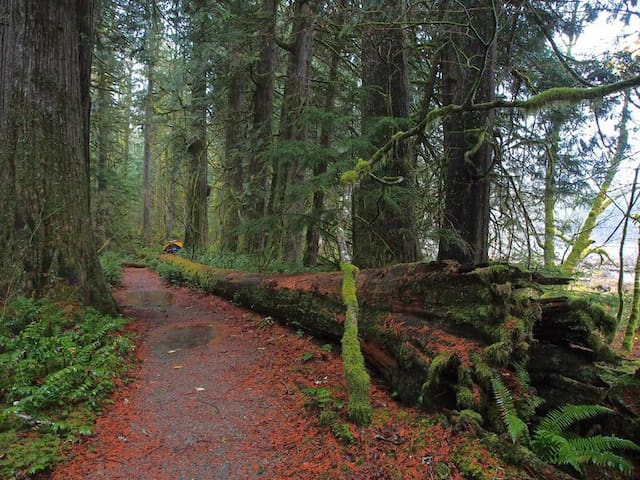
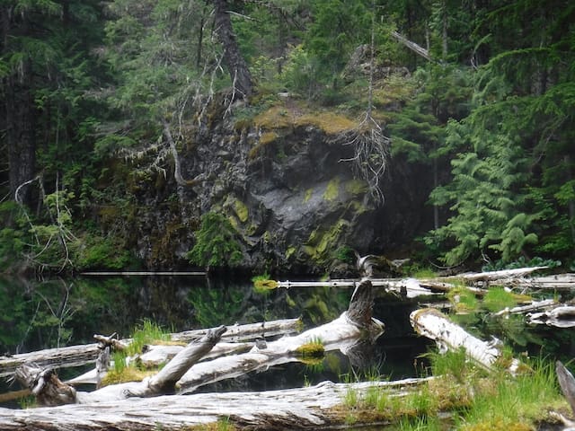
This is a nice, quiet little forest hike, where the journey is half the destination. The lake is pond sized, and surrounded by large boulders. It is pretty in its own way, a still lake with nice reflections, yellow waterlilies and silvered logs floating on the surface. The clumps of grasses and moss growing on the floating logs create a mini ecosystem to observe up close.
The trail starts next to Pyramid Creek, but the only view you will get of the creek is from the road at the beginning of the hike. For the first mile, you are in scrappy Douglas-fir and pine forest with half dead trees and salal understory.
The way is steep with loose rock, and can be hard on the knees going back down. If you turn back and look, you will see some glimpses of Sourdough Mountain and Davis Peak across the valley. In about a mile, cross a little stream; this is the outlet stream from the lake.
Here the forest changes to a beautiful green, with moss, deer fern and huckleberry bushes under healthy hemlock and cedar trees. There are some large old logs here from trees that have fallen and have since been cleared off the trail. The trail stays level for just a short ways, allowing you to catch your breath and look for some of the wildflowers that make their home in the shady forest.
As you hike, look for tiny twinflowers, bunchberry, foamflower and the penny sized pink flowers of pipsissewa, all close to the ground among the moss. After this nice break, you will start climbing again. Once you reach an impressive 5 inch diameter log where the trail has been cut through, you only need to switchback up the small ridge and drop down to the lake.
The path forks just before the lakeshore. For the best lunch spot, go left, up and around a couple of shrubs, and you will find some sitting rocks and a bit of shoreline. This is a small area and the only place close to the water. Don’t count on going swimming; while good to sit next to, this isn't the best lake to swim in.
Admire the silvered logs and the view of Pyramid Peak from here. If you go to the right at the fork, there is a path you can follow up to the large boulder that overlooks the lake. This is also a nice place for a lunch break. Here is the end of the official trail, although an unmaintained climbers path continues on.
Before you head back, take a closer look at the floating logs, You may spot the roundleaf sundew, a carnivorous plant that makes its home on partially submerged moss covered logs in freshwater bogs. It is tiny, you will need to look carefully. Before you leave home, look up pictures of this plant, latin name Drossera rotundifolia, so you know what to look for when you get to the lake.
https://www.wta.org/go-hiking/hikes/pyramid-lake
Pyramid Lake Trailhead
This is a nice, quiet little forest hike, where the journey is half the destination. The lake is pond sized, and surrounded by large boulders. It is pretty in its own way, a still lake with nice reflections, yellow waterlilies and silvered logs floating on the surface. The clumps of grasses and moss growing on the floating logs create a mini ecosystem to observe up close.
The trail starts next to Pyramid Creek, but the only view you will get of the creek is from the road at the beginning of the hike. For the first mile, you are in scrappy Douglas-fir and pine forest with half dead trees and salal understory.
The way is steep with loose rock, and can be hard on the knees going back down. If you turn back and look, you will see some glimpses of Sourdough Mountain and Davis Peak across the valley. In about a mile, cross a little stream; this is the outlet stream from the lake.
Here the forest changes to a beautiful green, with moss, deer fern and huckleberry bushes under healthy hemlock and cedar trees. There are some large old logs here from trees that have fallen and have since been cleared off the trail. The trail stays level for just a short ways, allowing you to catch your breath and look for some of the wildflowers that make their home in the shady forest.
As you hike, look for tiny twinflowers, bunchberry, foamflower and the penny sized pink flowers of pipsissewa, all close to the ground among the moss. After this nice break, you will start climbing again. Once you reach an impressive 5 inch diameter log where the trail has been cut through, you only need to switchback up the small ridge and drop down to the lake.
The path forks just before the lakeshore. For the best lunch spot, go left, up and around a couple of shrubs, and you will find some sitting rocks and a bit of shoreline. This is a small area and the only place close to the water. Don’t count on going swimming; while good to sit next to, this isn't the best lake to swim in.
Admire the silvered logs and the view of Pyramid Peak from here. If you go to the right at the fork, there is a path you can follow up to the large boulder that overlooks the lake. This is also a nice place for a lunch break. Here is the end of the official trail, although an unmaintained climbers path continues on.
Before you head back, take a closer look at the floating logs, You may spot the roundleaf sundew, a carnivorous plant that makes its home on partially submerged moss covered logs in freshwater bogs. It is tiny, you will need to look carefully. Before you leave home, look up pictures of this plant, latin name Drossera rotundifolia, so you know what to look for when you get to the lake.
https://www.wta.org/go-hiking/hikes/pyramid-lake
Follow the Diablo Lake Trail up and across talus slopes on the flanks of Sourdough Mountain to impressive cascading waterfalls and stunning views of Ross Lake and Colonial, Pyramid, Davis Peaks, as well as Jack Mountain.
The Diablo Lake Trail is an excellent choice year-round, but it's a particularly good option for an early season hike in the stunning North Cascades National Park, much of which is inaccessible during the winter and spring.
The trail starts out from the North Cascades Institute parking lot. Cross the Sourdough Creek trail -- which is not shown on the Green Trails map -- and follow the trail on a gentle uphill grade through old-growth forest. After climbing to 1500 feet, the trail crosses the dry streambed of Deer Creek, which provides a good demonstration of how powerful flood events can be in the North Cascades.
About 1.5 miles in, where tranmsission lines cross the trail, take a very short side trip to a vista of Diablo Lake. The views improve past this overlook, and begin to include non-stop views of Pyramid, Snowfield, Davis and Colonial Peaks. Walk slowly, both to soak in the views, and to watch your step -- a dizzying gorge, featuring waterfalls 700 feet high is coming up. Be sure to keep kids and dogs nearby! In winter, hikers can enjoy listening to only the sound of rushing water, since the highway visible across the way is closed to vehicle traffic.
Continue on, enjoying views of the vibrant blue lake. Just before reaching the switchbacks that lead 600 feet down to a suspension bridge near Ross Dam, hikers will cross an avalanche track. Be wary of this in winter and early spring -- it can be dangerous since that's where snow lingers on trail.
Shortly after crossing the avalanche chute, a rockslide blocks the east end of the suspension bridge at Ross Dam, so if you don't want to make the steep trek down to the bridge, you can rest at an overlook of Ross Lake Dam, enjoying the various North Cascades massifs that surround you. Take an inventory -- how many of the peaks can you identify?
Be sure to take your time on the way back; the views are equally impressive.
https://www.wta.org/go-hiking/hikes/diablo-lake
Diablo Lake Trailhead
Follow the Diablo Lake Trail up and across talus slopes on the flanks of Sourdough Mountain to impressive cascading waterfalls and stunning views of Ross Lake and Colonial, Pyramid, Davis Peaks, as well as Jack Mountain.
The Diablo Lake Trail is an excellent choice year-round, but it's a particularly good option for an early season hike in the stunning North Cascades National Park, much of which is inaccessible during the winter and spring.
The trail starts out from the North Cascades Institute parking lot. Cross the Sourdough Creek trail -- which is not shown on the Green Trails map -- and follow the trail on a gentle uphill grade through old-growth forest. After climbing to 1500 feet, the trail crosses the dry streambed of Deer Creek, which provides a good demonstration of how powerful flood events can be in the North Cascades.
About 1.5 miles in, where tranmsission lines cross the trail, take a very short side trip to a vista of Diablo Lake. The views improve past this overlook, and begin to include non-stop views of Pyramid, Snowfield, Davis and Colonial Peaks. Walk slowly, both to soak in the views, and to watch your step -- a dizzying gorge, featuring waterfalls 700 feet high is coming up. Be sure to keep kids and dogs nearby! In winter, hikers can enjoy listening to only the sound of rushing water, since the highway visible across the way is closed to vehicle traffic.
Continue on, enjoying views of the vibrant blue lake. Just before reaching the switchbacks that lead 600 feet down to a suspension bridge near Ross Dam, hikers will cross an avalanche track. Be wary of this in winter and early spring -- it can be dangerous since that's where snow lingers on trail.
Shortly after crossing the avalanche chute, a rockslide blocks the east end of the suspension bridge at Ross Dam, so if you don't want to make the steep trek down to the bridge, you can rest at an overlook of Ross Lake Dam, enjoying the various North Cascades massifs that surround you. Take an inventory -- how many of the peaks can you identify?
Be sure to take your time on the way back; the views are equally impressive.
https://www.wta.org/go-hiking/hikes/diablo-lake
This forested trail in the North Cascades National Park Complex leads down to Ross Lake and the network of trails in the Ross Lake National Recreation Area.
Look out over both Ross Lake and Ross Dam before making your way down to Ross Dam itself. The dam is part of the Skagit River Hydroelectric Project which supplies approximately 20% of the power requirements for Seattle City Light.
The Ross Dam Trail is often used to access Big Beaver Trail. While leashed dogs are permitted within the Ross Lake National Recreation Area, non-service animals are NOT allowed in the national park complex except on the Pacific Crest Trail.
https://www.wta.org/go-hiking/hikes/ross-dam-trail
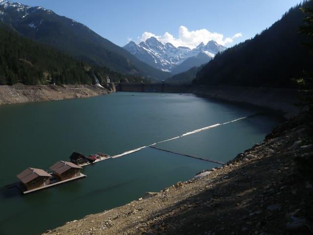
Ross Dam Trailhead
North Cascades HighwayThis forested trail in the North Cascades National Park Complex leads down to Ross Lake and the network of trails in the Ross Lake National Recreation Area.
Look out over both Ross Lake and Ross Dam before making your way down to Ross Dam itself. The dam is part of the Skagit River Hydroelectric Project which supplies approximately 20% of the power requirements for Seattle City Light.
The Ross Dam Trail is often used to access Big Beaver Trail. While leashed dogs are permitted within the Ross Lake National Recreation Area, non-service animals are NOT allowed in the national park complex except on the Pacific Crest Trail.
https://www.wta.org/go-hiking/hikes/ross-dam-trail
Located behind the Gorge Powerhouse in Newhalem, Ladder Creek Falls offers a refreshing woodland retreat with exotic flora and close-up views of the third tier of this spectacular waterfall. When the hydroelectric project near Ross Lake was under construction during the 1930s and '40s, owner and developer J.D. Ross built a trail to nearby Ladder Creek Falls to showcase the area.
The falls and surrounding gardens quickly became a tourist attraction, illuminated at night with colored lights and livened up by music that was piped in on Friday evenings for visitors who came from Seattle for a night out.
The light show remains an attraction, running a 15 minute repeating program from dusk until midnight year-round, but the falls are enjoyable at any time, day or night. After the construction of the Powerhouse, the falls lost much of their volume to the dam upstream. But because the diversion is above the falls, enough water remains in glacier-fed Ladder Creek to allow for year-round flow.
There are signs marking the short informative trail near the powerhouse. Meander along the path to the loud and misty falls, which offer a great respite from heat on hot summer afternoons.
The path is paved and there are several benches to rest on. Enjoy the falls, and then return to your car over a small suspension bridge. That offers a more direct route than the one you arrived on.
Ladder Creek Falls
State Route 20Located behind the Gorge Powerhouse in Newhalem, Ladder Creek Falls offers a refreshing woodland retreat with exotic flora and close-up views of the third tier of this spectacular waterfall. When the hydroelectric project near Ross Lake was under construction during the 1930s and '40s, owner and developer J.D. Ross built a trail to nearby Ladder Creek Falls to showcase the area.
The falls and surrounding gardens quickly became a tourist attraction, illuminated at night with colored lights and livened up by music that was piped in on Friday evenings for visitors who came from Seattle for a night out.
The light show remains an attraction, running a 15 minute repeating program from dusk until midnight year-round, but the falls are enjoyable at any time, day or night. After the construction of the Powerhouse, the falls lost much of their volume to the dam upstream. But because the diversion is above the falls, enough water remains in glacier-fed Ladder Creek to allow for year-round flow.
There are signs marking the short informative trail near the powerhouse. Meander along the path to the loud and misty falls, which offer a great respite from heat on hot summer afternoons.
The path is paved and there are several benches to rest on. Enjoy the falls, and then return to your car over a small suspension bridge. That offers a more direct route than the one you arrived on.
Trek a dry, strenuous trail to a famous fire lookout. Jack Kerouac stayed here as a lookout and used the experience to inspire Desolation Angels and Dharma Bums. The historic lookout is no longer accessible to the public, but you can still trek to the location and appreciate the view.
The trail begins on the East Bank Trail with views of Ross Lake. Two miles in, the trail turns east and begins climbing. You'll pass through cool forest and along a creek (fill up before you leave it, there's no more water available on this hike). The trees taper away into the subalpine vegetation. As the trees get disappear, the views improve! You can see Hozomeen Mountain in Canada to the north, the Pickets and Ross Lake to the west, and Jack Mountain to the south.
It's a challenging trek, climbing 4400 feet to the lookout perched on the top of the peak and at the northern edge of the country. You can see well into Canada from here.
https://www.wta.org/go-hiking/hikes/desolation-peak
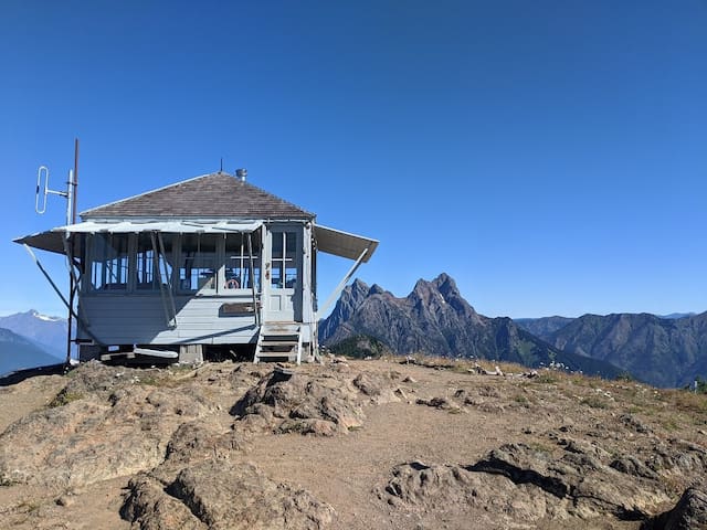
Desolation Peak
Trek a dry, strenuous trail to a famous fire lookout. Jack Kerouac stayed here as a lookout and used the experience to inspire Desolation Angels and Dharma Bums. The historic lookout is no longer accessible to the public, but you can still trek to the location and appreciate the view.
The trail begins on the East Bank Trail with views of Ross Lake. Two miles in, the trail turns east and begins climbing. You'll pass through cool forest and along a creek (fill up before you leave it, there's no more water available on this hike). The trees taper away into the subalpine vegetation. As the trees get disappear, the views improve! You can see Hozomeen Mountain in Canada to the north, the Pickets and Ross Lake to the west, and Jack Mountain to the south.
It's a challenging trek, climbing 4400 feet to the lookout perched on the top of the peak and at the northern edge of the country. You can see well into Canada from here.
https://www.wta.org/go-hiking/hikes/desolation-peak
Hikers can choose from an easy loop partially along Happy Creek, or a longer hike to Happy Creek Falls, site of an old sawmill that supported the mining in the late 1800's.
At the trailhead a very informative sign describes the history of the area and has a map of the nature trail.
The first part of the trail is an ADA compliant loop through the old growth forest of 0.3 miles mostly on boardwalk. The right branch (south) is all on boardwalk and overlooks Happy Creek. Halfway around the loop is the junction with the trail to Happy Creek Falls. The return part of the loop has more gravel trail as it wanders around the old trees. The entire loop is very shaded, even on a sunny day. This is a good walk for young children.
Even with a shallow gradient, the boardwalk can be pretty slick when wet, snowy or icy.
From the nature trail, the trail to the falls is of a completely different character. The initial section climbs away from Happy Creek on a duff tread into a more open forest and a peek-a-boo view of Ross Lake and Jack Mountain. The trail traverses about 100 feet above State Route 20, so the road noise is quite evident.
At 0.4 miles, a boot trail comes in from a pullout on SR 20. At 0.9 miles, the trail starts climbing steeply through the moss covered rock outcrops. The trail becomes quite rocky, even small streambeds in places. After leveling off and re-entering the old forest, the trail nears Happy Creek again. A short climb along the creek passes some of the antique saw mill equipment, before reaching the base of the falls at 1.3 miles.
The falls are a series of short steps down a steep gully. In spring and late fall, the falls are fairly full. In late summer, they are a more of a trickle between the rocks.
https://www.wta.org/go-hiking/hikes/happy-creek-nature-trail
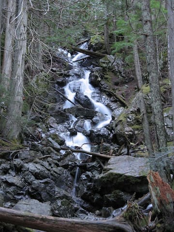
Happy Creek Trailhead
Hikers can choose from an easy loop partially along Happy Creek, or a longer hike to Happy Creek Falls, site of an old sawmill that supported the mining in the late 1800's.
At the trailhead a very informative sign describes the history of the area and has a map of the nature trail.
The first part of the trail is an ADA compliant loop through the old growth forest of 0.3 miles mostly on boardwalk. The right branch (south) is all on boardwalk and overlooks Happy Creek. Halfway around the loop is the junction with the trail to Happy Creek Falls. The return part of the loop has more gravel trail as it wanders around the old trees. The entire loop is very shaded, even on a sunny day. This is a good walk for young children.
Even with a shallow gradient, the boardwalk can be pretty slick when wet, snowy or icy.
From the nature trail, the trail to the falls is of a completely different character. The initial section climbs away from Happy Creek on a duff tread into a more open forest and a peek-a-boo view of Ross Lake and Jack Mountain. The trail traverses about 100 feet above State Route 20, so the road noise is quite evident.
At 0.4 miles, a boot trail comes in from a pullout on SR 20. At 0.9 miles, the trail starts climbing steeply through the moss covered rock outcrops. The trail becomes quite rocky, even small streambeds in places. After leveling off and re-entering the old forest, the trail nears Happy Creek again. A short climb along the creek passes some of the antique saw mill equipment, before reaching the base of the falls at 1.3 miles.
The falls are a series of short steps down a steep gully. In spring and late fall, the falls are fairly full. In late summer, they are a more of a trickle between the rocks.
https://www.wta.org/go-hiking/hikes/happy-creek-nature-trail
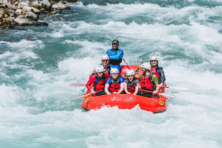
336 36th St suite 191
336 36th StreetWhitewater rafting on the Skagit
https://triadrivertours.com/
Kayak and canoe rental outfitter and shuttle service. Advanced reservations are required. Float Skagit launches from two locations in Skagit Valley or available for overnight rental. Relaxing, beautiful and quiet.
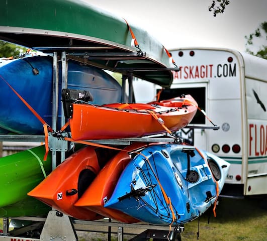
Float Skagit
19041 Beaver Marsh RoadKayak and canoe rental outfitter and shuttle service. Advanced reservations are required. Float Skagit launches from two locations in Skagit Valley or available for overnight rental. Relaxing, beautiful and quiet.
Eat and Drink
5bs is a neighborhood bake shop nestled in the foothills of the Cascade Mountains where everything is made from scratch in small batches, with special attention to using quality local ingredients.
Their signature 5seed bread to our famous cinnamon rolls, our quality, classic baked goods and desserts are baked fresh daily, from their own recipes.
5bs takes its style from the 40's when everything was made in house. Their soups are made daily all from scratch and they even cure and smoke their own meats.
Their time-tested recipes and wide selections make 5b's Bakery Dedicated Gluten Free any food lover's destination.
12 persone del luogo consigliano
5b's Bakery
45597 Main St5bs is a neighborhood bake shop nestled in the foothills of the Cascade Mountains where everything is made from scratch in small batches, with special attention to using quality local ingredients.
Their signature 5seed bread to our famous cinnamon rolls, our quality, classic baked goods and desserts are baked fresh daily, from their own recipes.
5bs takes its style from the 40's when everything was made in house. Their soups are made daily all from scratch and they even cure and smoke their own meats.
Their time-tested recipes and wide selections make 5b's Bakery Dedicated Gluten Free any food lover's destination.
Rated 2nd best pizza in the entire state by King5 Best of Washington People's Choice Awards.
Annie’s Pizza Station, family owned and operated, began in 1994 in a converted gas station in downtown Concrete. This inspired pizza names such as Diesel, Regular, Supreme and Unleaded. (Their present location is also a former gas station.) The theme goes much deeper into the old service philosophy of early-day gas stations, when attendants took care to wash windows, hand out travel maps, and provide clean restrooms.
They take pride in using quality ingredients, freshly prepared to order. They bake all their breads and pizza crusts from scratch. Salads are prepared with hand-torn lettuces. They make their own soups and lasagnas.
Their pizzas are baked in traditional stone-lined deck ovens, resulting in pizzas with a unique taste and texture. However, this combination of custom-made pizzas and limited oven capacity sometimes results in longer wait times than “fast food” pizzas. Be patient and we’re sure you’ll love the results. Phoning in your order is suggested, and reservations are encouraged for larger groups.
12 persone del luogo consigliano
Annie's Pizza Station
44568 State Rte 20Rated 2nd best pizza in the entire state by King5 Best of Washington People's Choice Awards.
Annie’s Pizza Station, family owned and operated, began in 1994 in a converted gas station in downtown Concrete. This inspired pizza names such as Diesel, Regular, Supreme and Unleaded. (Their present location is also a former gas station.) The theme goes much deeper into the old service philosophy of early-day gas stations, when attendants took care to wash windows, hand out travel maps, and provide clean restrooms.
They take pride in using quality ingredients, freshly prepared to order. They bake all their breads and pizza crusts from scratch. Salads are prepared with hand-torn lettuces. They make their own soups and lasagnas.
Their pizzas are baked in traditional stone-lined deck ovens, resulting in pizzas with a unique taste and texture. However, this combination of custom-made pizzas and limited oven capacity sometimes results in longer wait times than “fast food” pizzas. Be patient and we’re sure you’ll love the results. Phoning in your order is suggested, and reservations are encouraged for larger groups.
Birdsview Brewing Company is a small craft brewery located in scenic Birdsview, Washington. They brew all of their beer on site. They are family owned and operated, and offer an easygoing, relaxing atmosphere.
10 persone del luogo consigliano
Birdsview Brewing Company
38302 State Rte 20Birdsview Brewing Company is a small craft brewery located in scenic Birdsview, Washington. They brew all of their beer on site. They are family owned and operated, and offer an easygoing, relaxing atmosphere.
Amazing ice cream from Wisconsin! Their flavors are constantly changing so you can be adventurous and try something totally new. All their ice cream is rich and flavorful, made with the finest ingredients.
Act One also offers sundaes, milkshakes, floats and affogatos (an espresso sundae).
Their espresso bar serves Cafe Mam coffee from Oregon. Enjoy an Americano, latte with flavors and milk of your choice, mocha, breve and more.
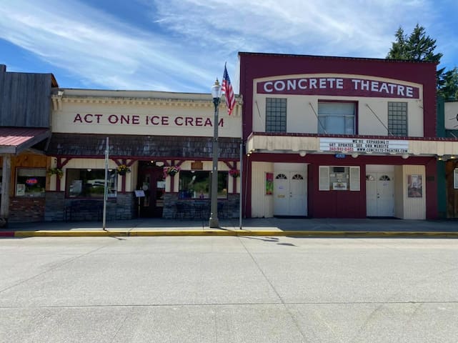
Act One Ice Cream Parlor
45924 Main StreetAmazing ice cream from Wisconsin! Their flavors are constantly changing so you can be adventurous and try something totally new. All their ice cream is rich and flavorful, made with the finest ingredients.
Act One also offers sundaes, milkshakes, floats and affogatos (an espresso sundae).
Their espresso bar serves Cafe Mam coffee from Oregon. Enjoy an Americano, latte with flavors and milk of your choice, mocha, breve and more.
All-day breakfast, huge menu, drinks, and a pool table. The sidewinder fries are a must-have!
The Lonestar
45930 Main StAll-day breakfast, huge menu, drinks, and a pool table. The sidewinder fries are a must-have!
Cascade Burgers
45292 State Rte 20Burgers, handcut curly fries, and delicious onion rings.
Cozy diner with plenty of outdoor space for families and dogs. Check for events in the summer.
https://www.birdsviewdiner.com/
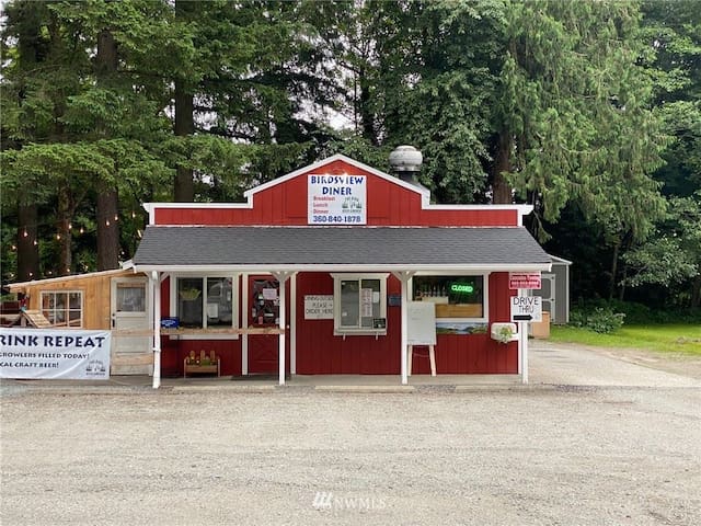
Birdsview Diner
39974 State Route 20Cozy diner with plenty of outdoor space for families and dogs. Check for events in the summer.
https://www.birdsviewdiner.com/
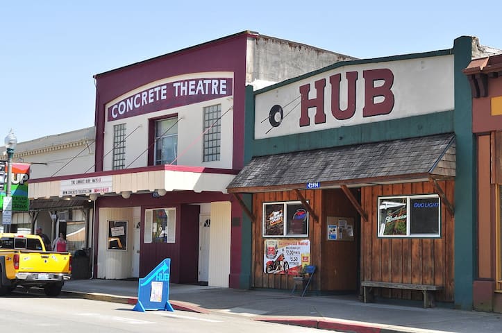
Hub Bar & Grill
45914 Main StreetA place to relax. Complete with cold beer, eats, and ghosts!
North Cascade's Perks Espresso and Deli serves Fidalgo Coffee, baked goods, breakfast, and lunch.
North Cascades Perks
44586 State Rte 20North Cascade's Perks Espresso and Deli serves Fidalgo Coffee, baked goods, breakfast, and lunch.
Drive-thru espresso, energy drinks (Lotus & Red Bull), milkshakes with soft serve ice cream, breakfast sandwiches, and pastries. In the Logger’s Landing parking lot.

Javazone
45284 State Route 20Drive-thru espresso, energy drinks (Lotus & Red Bull), milkshakes with soft serve ice cream, breakfast sandwiches, and pastries. In the Logger’s Landing parking lot.
Rockport Bar is place for everybody with a beautiful river view. Great Beer Garden with Horseshoe pits and relaxation.
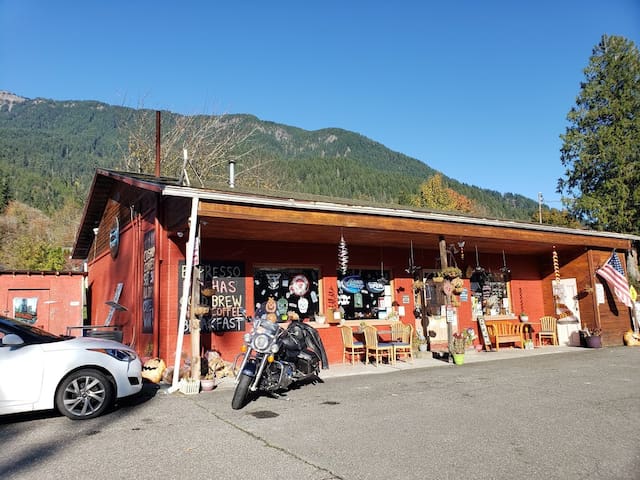
Rockport Bar & Grill
52807 Railroad AvenueRockport Bar is place for everybody with a beautiful river view. Great Beer Garden with Horseshoe pits and relaxation.
Mondo Restaurant opened the Summer of 2012! It is a combination of Korean and American food! Great people, great atmosphere and great food!
Mondo Restaurant
60102 State Rte 20Mondo Restaurant opened the Summer of 2012! It is a combination of Korean and American food! Great people, great atmosphere and great food!
Korean BBQ joint. Outdoor garden and outdoor patio where you can enjoy the sunshine and flower blossom while dining in during summer season.
Miga Korean Restaurant
44618 State Rte 20Korean BBQ joint. Outdoor garden and outdoor patio where you can enjoy the sunshine and flower blossom while dining in during summer season.
Supplies
Full grocery store with food, beverages, ice, alcohol, fishing/hunting licenses, etc.
11 persone del luogo consigliano
Albert's Red Apple Market
44546 State Rte 20Full grocery store with food, beverages, ice, alcohol, fishing/hunting licenses, etc.
Fishing and hiking gear are available here. Stop by for advice on local fishing spots.

Outdoor Ventures
44580 State Route 20Fishing and hiking gear are available here. Stop by for advice on local fishing spots.
Cascade Supply
45900 Main StLocal hardware store.
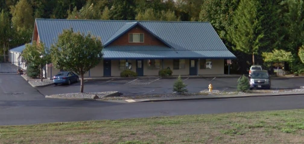
Shop and Save America
45080 Fir StreetSmall convenience store.

Young Market
44584 State Route 20Small convenience store.

Concrete Post Office and City Hall
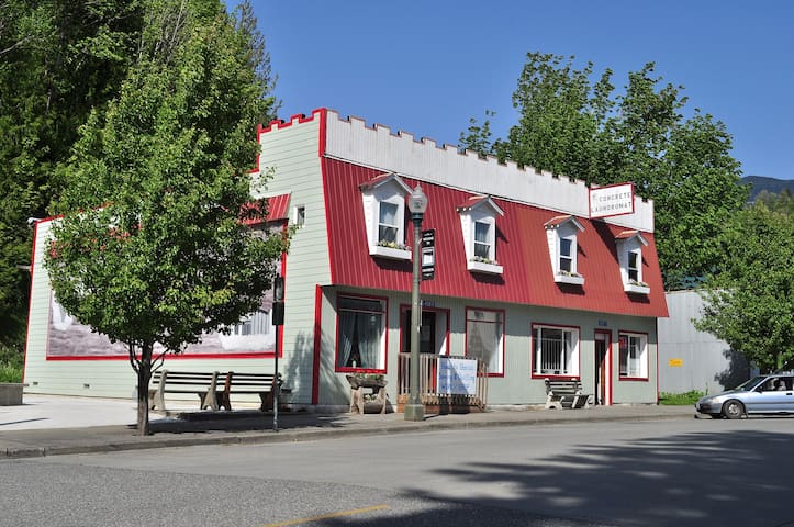
Concrete Laundromat
45871 Main StreetCoin operated laundromat.
Shopping
Wood-fired stoneware and porcelain to use and to admire. Designs include relief drawings of the Cascade Mountains, local flowers and some wildlife.
Sauk Mountain Pottery
50303 State Rte 20Wood-fired stoneware and porcelain to use and to admire. Designs include relief drawings of the Cascade Mountains, local flowers and some wildlife.
Located on Main Street in downtown Concrete, Baker River Woodworks is a unique shop offering the natural beauty of wood transformed into heirloom furniture.

Baker River Woodworks
45880 Main StLocated on Main Street in downtown Concrete, Baker River Woodworks is a unique shop offering the natural beauty of wood transformed into heirloom furniture.
Wedding and special event florist, beautiful award winning design work with over 25 years experience. Featured in florist review magazine.

Dawn's Floral & Gifts
45948 Main StreetWedding and special event florist, beautiful award winning design work with over 25 years experience. Featured in florist review magazine.
Northwest Garden Bling is a unique gift shop & working studio featuring stained glass and mosaic.
Northwest Garden Bling
44580 State Rte 20Northwest Garden Bling is a unique gift shop & working studio featuring stained glass and mosaic.
Cement City Swap Meet
Local outdoor flea market.
Closed for the 2022 season.
Their story begins nearly 50 years ago on a little stretch of land next to the magic blue Skagit River in the foothills of the Northern Cascades. Although they've outgrown their original farm—they source from certified organic farms throughout the country and world to make our delicious products—you can still visit the farm that inspires them. Our original Home Farm is a working organic farm where we grow blueberries, raspberries, strawberries, sweet corn, and pumpkins. Their roadside stand serves farm-grown organic produce, homemade ice cream, berry shortcake, espresso, and wholesome snacks. Enjoy a picnic near our native pollinator flower garden with views of the river and glacier covered mountains. Learn about this unique place that continues to propel the organic and regenerative agriculture movements. The scenic drive alone is well worth the trip!
Cascadian Farm Home Farm
55391 State Rte 20Closed for the 2022 season.
Their story begins nearly 50 years ago on a little stretch of land next to the magic blue Skagit River in the foothills of the Northern Cascades. Although they've outgrown their original farm—they source from certified organic farms throughout the country and world to make our delicious products—you can still visit the farm that inspires them. Our original Home Farm is a working organic farm where we grow blueberries, raspberries, strawberries, sweet corn, and pumpkins. Their roadside stand serves farm-grown organic produce, homemade ice cream, berry shortcake, espresso, and wholesome snacks. Enjoy a picnic near our native pollinator flower garden with views of the river and glacier covered mountains. Learn about this unique place that continues to propel the organic and regenerative agriculture movements. The scenic drive alone is well worth the trip!
Entertainment
The historic Concrete Theatre was built in 1923 and is the oldest movie theatre in Skagit County. Plays modern movies as well as classics!
6 persone del luogo consigliano
Concrete Theatre
45920 Main StThe historic Concrete Theatre was built in 1923 and is the oldest movie theatre in Skagit County. Plays modern movies as well as classics!
Concrete has a public airport, world-class vintage aircraft museum, and an annual Fly-In event!
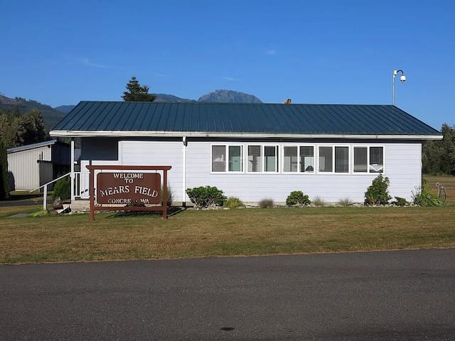
Mears Field Pilot's Lounge
7879 South Superior AvenueConcrete has a public airport, world-class vintage aircraft museum, and an annual Fly-In event!
Consigli per viaggiatori
Usanze e culture
How Concrete got its name
Early settlers came to the Baker River in 1871, originally calling the settlement on the west bank “Minnehaha.” In 1890, the townsite was platted by Magnus Miller, a post office was set up, and the name “Baker” was adopted. On the east bank of the river, the community that sprang up around the Washington Portland Cement Company (1905) was named “Cement City.” After the Superior Portland Cement Company plant (1908) was built in Baker, it was decided to merge the two towns, and in 1909, after much discussion, the new community settled on the name “Concrete.”
Da non perdere
Concrete Saturday Market
Every Saturday from 10am-2pm through September 3, 2022 at the community center.
https://www.concretesaturdaymarket.com/